Search This Blog

Showing posts with label Chiricahua National Monument. Show all posts

Monday, January 23, 2023

Another Exhilarating, Exhausting Mountain Adventure!

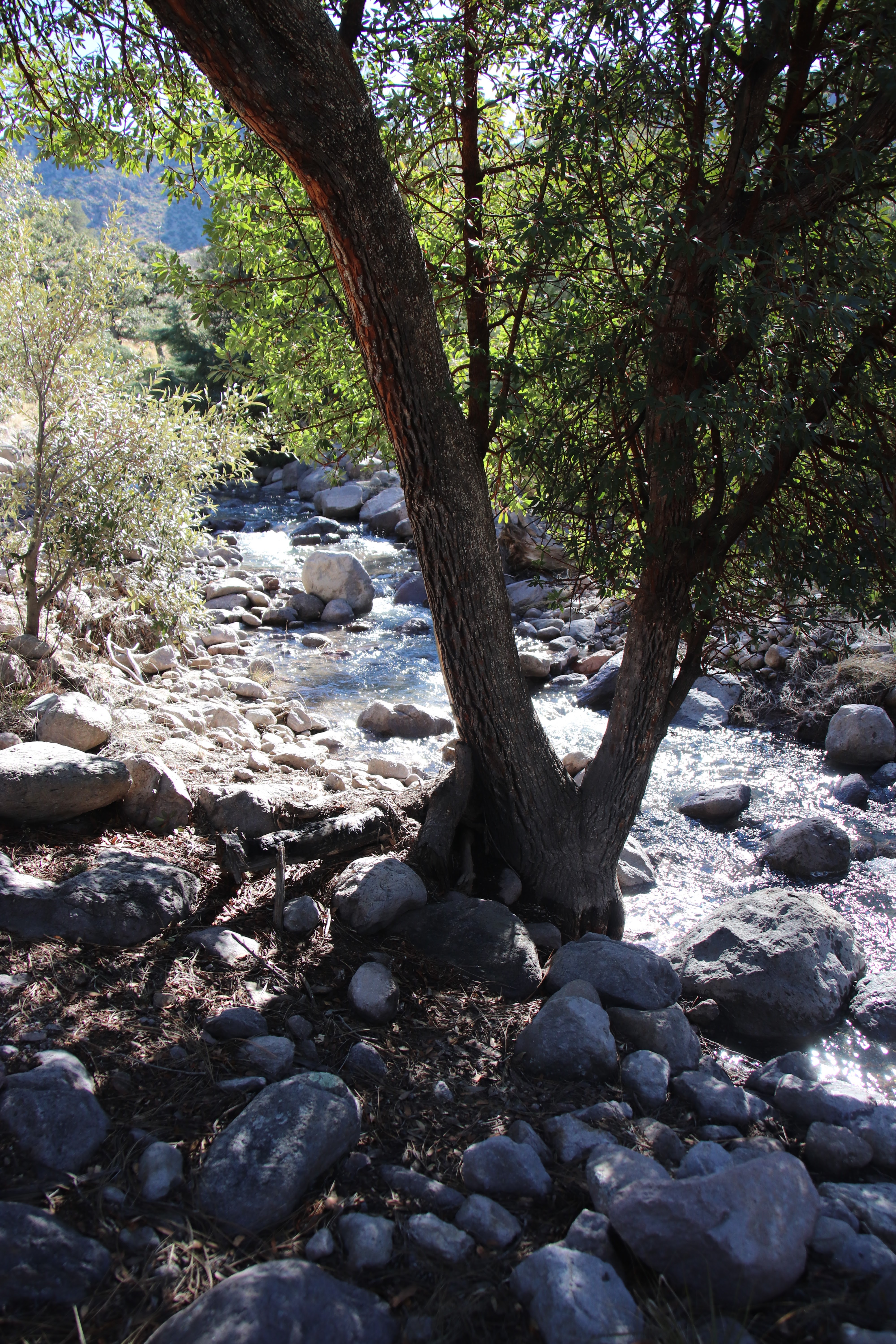
Bonita Creek at visitors center parking lot, 1/22/23


My hiking partner wanted to introduce her new puppy to the Chiricahua National Monument and invited me to come along. We would hike a short trail, the one between Faraway Ranch and the visitors center, a trail that more or less follows Bonita Creek, does not involve climbing, and where dogs on-leash are allowed – in short, an easy trail that shouldn’t give a three-month-old puppy any trouble at all.


Over the years following our first introduction to the place, the Artist and I made countless visits to the CNM, an easy drive from the ghost town, down one of the most beautiful Cochise County roads. We picnicked along rocky Bonita Creek (bone-dry in December of 2021) and explored lovely Faraway Ranch and its history. We had walked about a mile of the trail beginning at the other end, too; however, although the trail between its two end points is only 1.2 miles, I had never walked the entire length at one go. 


My friend and I, having decided to begin our round-trip walk at the visitors center end, were delighted to see water in the creek. Not just a thin trickle, either. The park is a treasure even when the creek is dry, but running water, in Arizona, is always exciting and adds to outdoor experience.


Creek below, peak above


We stopped often, pointing out to each other particular stunning vistas and giving the puppy a chance to explore with her nose. My appreciation of the trail’s beauty was somewhat tempered by sorrow that the Artist was no longer with me, as memories of being there together came at every turn. But it was a beautiful day, and I was glad to be in the mountains. 


This is the trail???


My first challenge came when our trail, familiar to me in this stretch, took on a very unfamiliar look: I had never seen this much water in the creek that crossed the trail at right angles. My friend picked her puppy up in her arms and stepped bravely from rock to rock. I tried, but the necessary steps between rocks were too long for me to take them in stride, as it were. As I saw it, I had two choices: 


Wading the creek: The water was icy cold, and my boots not water-proof. My feet would get wet and cold. 


On the other hand –


Taking the rock route: If I slipped and fell, more than my feet would get wet, and falling on rocks could mean getting a lot more than wet. What if I slipped and fell and hit my head? No cell phone signal! Very few people on the trail that day. (The whole time we were on the trail, we saw only four other people, one couple from each direction, and all turned back from what was for us the third creek crossing.)


So I scouted out the shallowest path I could see, hiked up my jeans, and waded across. Yes, it was very cold!


Having taken the plunge already, our second creek challenge was easier for me. The creek was wider and shallower there. Again, my friend carried her puppy.


Does not look challenging You are not looking at it with cold, wet feet.


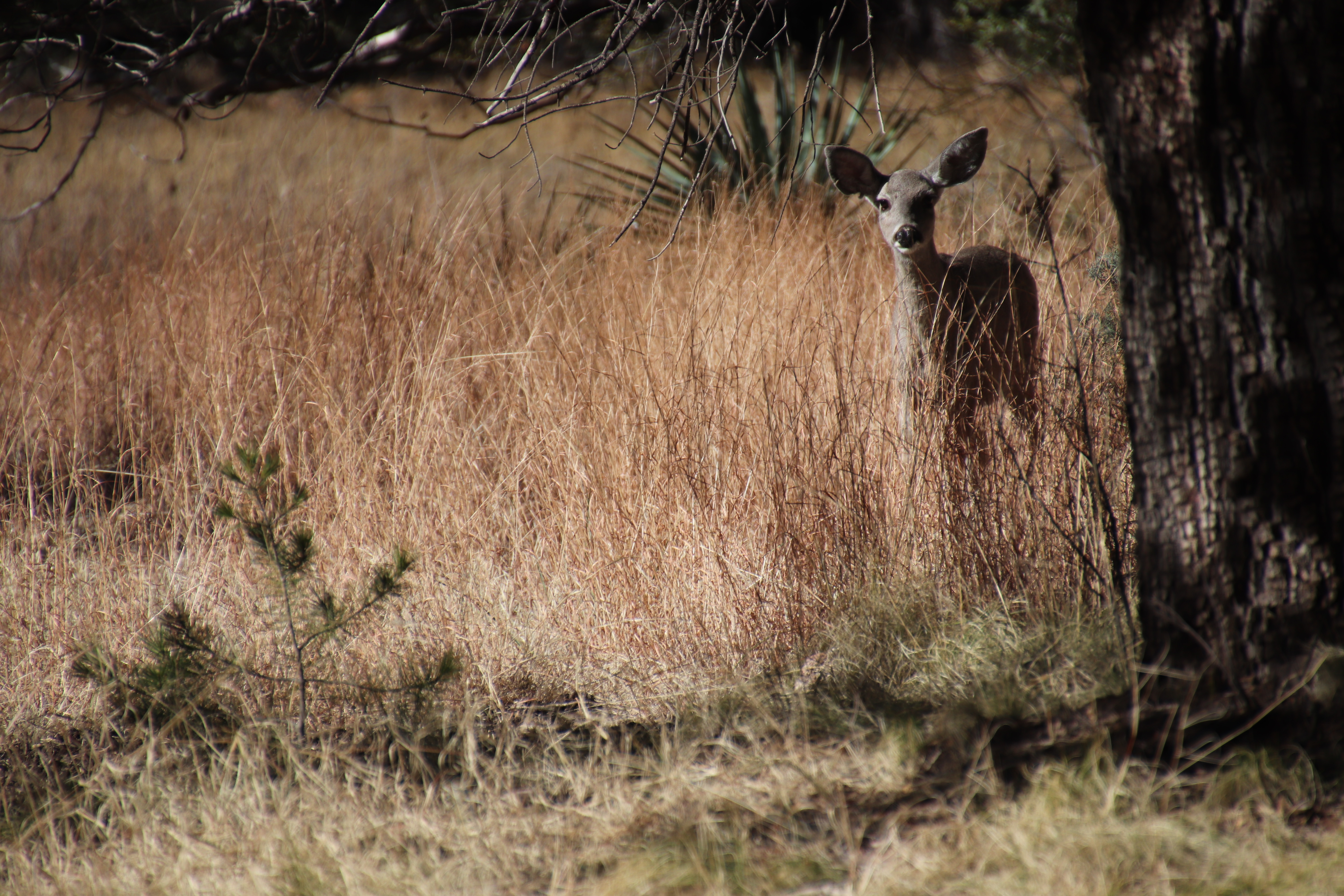
We were hoping to see coati, and those hopes were not realized on Sunday, but approaching Silver Spur meadow we saw deer and stopped to watch their lovely, easy, flowing trot across our path and up into the woods. As you might guess, the puppy was mesmerized by the sight. My year-old puppy would have barked, had she been with us.


Farther along came Challenge #3. Intrepid wader by now, I crossed pretty much with the submerged path, while my friend explored downstream for solid rocks, and a couple who had caught up with us on the trail explored upstream. The other people turned back, but my friend made a daring and successfully dry crossing while I held my breath, praying that she would not lose her footing. 


Exploring upstream before turning back


My fearless friend!

Pup in arms!

Still high and dry!


On dry land once more, we came to one of my friend’s favorite trees. It turns out she is, literally, a tree hugger! The puppy found greater interest in a trunk hollowed out by fire, as we humans admired the grain of its wood.


Oops! Puppy moved out of shot....


Now we had gone beyond my former explorings, and soon we came to something I had never seen before: the Stafford Cabin. Sweet! You can read about its history and the family who lived in the cabin here.


From there it was an easy walk to beloved Faraway Ranch, where we walked around the old house, renewed familiarity with its history, and visited with a group of people from Alaska before turning back in the direction of the visitors center, taking a slight detour from the house to go by a ranger’s cabin. One of the things I always think about at Chiricahua is how one of the grandsons, a forester with experience in public works forestry, would love the place. In my mind’s eye, I can see him here, living in this cabin and enjoying the views. 


Ranger cabin

Looking back at Faraway Ranch

Savannah-like open area

The biggest surprise of the day was manzanita in bloom – in January! 


Manzanita flowers


There were, of course, three more crossings of Bonita Creek to make on our way back – three more times for me to wade through icy water in boots and socks already soaked through, three more times for my friend to negotiate a dry, rocky crossing with puppy I her arms. End of tale: I was wet halfway up to my knees, my friend slipped and got one foot wet, the puppy managed to get into fresh, black mud, but otherwise all three of us did just fine. 


Being on the trail Sunday was definitely worth wet feet. I thought of Washington Irving on his expedition through Oklahoma territory (A Tour on the Prairies) and how important it was for their party to find a camping spot near water each night. By contrast, I would soon be back in my comfortable, warm cabin, where I could put on dry socks and relax with my own puppy. But to have seen so much water in the creek, sparkling in the sunlight, was a thrill. 


Reaching home, tired but contented, I went out for a ramble with Sunny Juliet before even changing my footwear, because my puppy needed some fun in the sun, too! -- You’re probably wondering why Sunny Juliet was not included on the adventure. She and Yogi have met each other and have compatible energy levels and play styles, so we anticipate they will be great pals soon, but Yogi is so little right now that my friend and I don’t want to stress her out too much or take a chance that she will be hurt accidentally by a rowdy, much bigger dog. The good news is that Yogi will be bigger every week, and we look forward to playtime together with the two of them. As for trail hikes with the two of them, two excited puppies on-leash, that might be more than I could handle, even with dry feet.


My girl on Big Rock (one of them)!


Tuesday, January 21, 2020

Just Out the Door and Down the Road


This morning’s sky confirmed the forecast I’ve been seeing on my phone for several days: we’re in for a rainy day — and that’s not bad. A day of rain now and then damps down the risk of fire, a good thing in the high desert. The prediction for the next nine days following today’s rain is for mostly sun with a few clouds. Today we're in for an all-day soaker. Fine.


We made an afternoon expedition on Saturday to the spectacularly beautiful Chiricahua National Monument, where crowds I expected to see on a holiday weekend were largely absent. Absent also (and this was a real blessing) was the strong, cold wind we normally encounter up on Massai Point. Although the air temperature kept dropping as we wound our way to the 6,870-ft. peak, and we saw increasingly larger patches of snow along the narrow, winding road, sunshine was absolutely glaring when we reached the high end of the road, and on a strategically placed bench, looking out over the astonishing hoodoos, across the 40-square-mile playa and surrounding Sulphur Springs Valley to the Dragoon Mountains seventy miles to the west, we were out of even the slightest breeze and content to soak up sun to our hearts’ content.


After five years, I’m finally getting some light grip on the geology of Cochise County, Arizona, and the sky islands of this basin-and-range country. At least, I think I am, but don’t quiz me. Instead, correct me if you think I’ve gone astray. 

To understand the formation of the Chiricahua range, we have to go back twenty-seven million years and the movement of tectonic plates those 27,000,000 years ago, when the molten core of the earth was much more active and closer to the surface than it is in Arizona today. Back then a dense oceanic plate of basalt was overridden by a lighter plate of granite (the North American plate, moving west in true though still prehistoric North American fashion), and as the resulting collision (friction?) increased both rock and water temperature, the former melted as it mixed with the already molten mantle. 

Just south of the Monument (which in itself occupies only a portion of the entire Chiricahua range) are the remains of what is known as the Turkey Creek Caldera. There a magma chamber broke through the earth’s crust and spewed burning gas, ash, and lava over 1,200 square miles in an explosion estimated to be five to ten times larger than the historic Krakatoa eruption in 1883. 

Turkey Creek is so calm and quiet today that it’s almost impossible to picture the nuée ardente — scorching rain! — that flew upward from the prehistoric volcano and flowed outward at over 100 miles an hour as a burning avalanche! In time, of course, the magma cooled and hardened, forming a rhyolite bedrock over eight hundred feet thick. And that and similar eruptions were the birth of the Chiricahua mountains.

But basin and range land is not created by volcanos alone. Once the dramatic volcanic events are over and plate movement slows down, everything gradually cools, and it is then that the cooling masses of rock, slowly but irresistibly, shove against each other, faulting, tilting, and lifting some segments up, while the surrounding basins sink. The creation of Arizona’s sky islands, then — these fault-block mountain ranges that rise up from a nearly level sea (though 4,000+ feet above sea level) of grassland and desert — was very unlike that of the folded Appalachians with their more gradual slopes. 


Nor, however, is faulting, tilting, and rising the end of the story, because subsequently comes the much slower action of weathering. Wind and water (in liquid and solid form) take starring roles in the weathering story but achieve their dramatic effects at very undramatic speed.
Formed by case hardening caused by the amorphous silica left behind after precipitated water evaporates off the surface of the rock formations, pinnacles in Chiricahua National Monument were formed by the freezing and thawing of water during the last ice age approximately ten thousand years ago. 
- William Ascarza, Chiricahua Mountains: History and Nature
Sculpted rhyolite makes for stunning scenes in Chiricahua, where jointed columns of rock invite “the entry of water, instigating chemical and physical weathering.”


Less spectacular but as much a part of the geologic story as the hoodoos are “solution pans” and “slot canyons,” the latter “forty times deeper than they are wide” (Ibid.).

We do not always think about it when admiring mountain hoodoos and the other rock formations we find so amazing, but weathering is a relentlessly ongoing process, continuing in our own age, day by day. Saturday there were pockets of snow in the mountains. As sun reached some of them, that snow melted, and meltwater sought out cracks through which it could descend to creeks and rills headed for the playa. Perhaps that ultimate destination would not be reached, but water would push its way along as far as possible, carrying with it occasional small bits of rock and stone. 


And on the other side of the mountain from where we found our sheltered bench, wind was doing the work it does night and day.


Because of weathering, all the sky island peaks have been worn down from their original height, and the valleys — recipients of eroded mountain material — have gained in elevation. Today’s rain is a geologic drop in the bucket, but each raindrop, each snowflake, contributes to the cumulative effect.


The Artist and I never view Chiricahua with jaded eyes. Every visit feels like the first time, so unusual and fascinating and mentally challenging are the sights. For me, though, the presence of tall, green trees is almost as exciting as the rock formations. Down in our winter ghost town we have only mesquite and netleaf hackberry, whereas in Chiricahua there are beautiful alligator juniper, Gambel oaks, Douglas firs, and stately Ponderosa pine. We are so very lucky, we tell each other, to have all this natural beauty practically in our backyard! It doesn’t even have to be a day trip: half a day gets us there, gives us time for a walk and a picnic, and gets us back to our own Dos Cabezas, which are, literally, in our backyard, so that coming back home at the end of the day is never a disappointment.


Back in Michigan, where we live maybe a mile from the glory of Lake Michigan, we don’t see the water from our windows, but neither do we pay lakeshore property tax or worry that rising lake levels will carry off our home. The closest road to the Lake is private, so we have to take a little ride to get to a beach, but it isn’t all that far, and on mornings after stormy, windy nights we can hear the waves from our front door. Thus it is well within our reach, that glory — even closer than it was when we lived in Kalamazoo and I occasionally needed a 100-mile evening round trip so I could walk on the beach to unwind after a day of work at a job I did not love.

I was lucky even in my girlhood, when the house my parents bought for our move from South Dakota to Illinois was on the last street of a subdivision, out beyond the city limits, with a working farm across the road to the west. How hungrily and greedily and gratefully, too, I watched thunderstorms and sunsets in that open expanse from our enclosed front porch! 

South Dakota, Illinois, Michigan, Arizona. Fields, lakes, desert, mountains. Just outside the door or maybe a little way down the road, open spaces and natural beauty have always helped me breathe deeply and filled me with peace.

Sources: 

1. Ascarzs, William. Chiricahua Mountains: History and Nature (Charleston, SC: Natural History Press, 2014)

2. Gilluly, James; A. C. Waters; & A. O. Woodford. Principles of Geology, 2nd ed. (San Francisco: W. H. Freeman & Co., 1959).


Monday, March 18, 2019

Happy Mountain Trails: I Passed the Test!


Reading, Beforehand the Challenge

Back in spring of 2015, my hiking guide from the Dragoon Mountains adventure and I set out to explore the old Fort Bowie road, planning to hike in from the road to the ruins of the fort. Sadly, a flat tire and a long wait for road service (a “donut” tire would not have gone far in the mountains!) ate up much of the morning, and as she was no longer confident on the unpaved, washboard road, full of sharp rocks, we went back to the highway and continued southeast to Chiricahua National Monument. The biggest error of that day, though, was taking Sarah along. Let me say only: dogs on leashes — not good for hiking in mountains! 

So this year, when my neighborhood dog-walking companion and I made a date to hike in Chiricahua, we agreed: no dogs! This was one adventure Therese and I would have without Buddy and Mollie and Sarah.

I was up before the sun on St. Patrick’s Day Sunday morning, with absolutely the perfect pre-hike reading, a copy of Range Roaming: A Birdwatcher’s 65-Plus Year Love Affair with the Chiricahua Mountains, by Betty Jones, published by the family after the authors death. I’d left off reading the night before at the end of the chapter just preceding the one on the Chiricahua National Monument, and so with my pre-dawn, pre-hike morning coffee I read about Betty’s camping and hiking and birding in the Monument itself (the Monument being only a small part of the entire mountain range), continuing after the sun had risen to the next chapter, on birding in Patagonia, where friends of ours wintered for years and where we visited them in their last year of life. That brought a few sighs, I must say, as I inspected the map closely to locate Jim and Linda’s house with respect to the creek we had forded to get there on our first visit back in the 1990s….

Range Roaming isn’t the easiest book to read or navigate, for a couple of reasons. One confusing feature is that the sketchy maps — and don’t get me wrong: I’m glad to have even sketchy maps — are not all presented in the conventional manner with North at the top of the page. In the various maps throughout the book, North can appear at the top, at the bottom, on the side; in other words, it might be anywhere. I kept turning the book around in my hands to put North at the top — but that meant trying to read the names of identified features (roads, paths, peaks, etc.) upside-down or sideways. As I say, not easy.

Another problem — for me — is that it’s obvious the manuscript preparation was not professionally done, and my inner editor and proofreader were working their fool heads off practically nonstop as I read. But that’s a personal comment, not a harsh complaint, because I am very happy to have this book, which is nothing like anything else I’ve seen on the area. It’s worth its cover price, even if the possessive its and the contraction it’s, among other little niceties of grammar and punctuation, failed to get sorted out before publication. 

Many of the hikes Jones took are no longer possible, and neither can people still camp everywhere she did, as land open to her in the 1960s and 1970s is now off-limits to the public, but other trails and campgrounds are still available, and her descriptions of the wildflowers, birds, and butterflies a visitor might hope to encounter are enough to whet the appetite of the least-educated amateur naturalist. (In fact, I can’t help regretting in advance that I will not be able to explore Chiricahua in the summer, during the exciting thunderstorms and when the bright red flowers and the various species of hummingbird that feed on them will be on full display.) I also appreciate the history of the Monument lands included with the author’s boots-on-the-ground adventures. Reading of work accomplished by the Civilian Conservation Corps, for example, I think proudly of our older Minnesota grandson and his summer work along those same lines. And while I knew the Buffalo Soldiers had played a large role in the history of southeast Arizona, I did not realize before reading it in this book that they “briefly occupied the grounds on what is now the Faraway Ranch Historic District.” This is the kind of history that means the most to me — very local history of specific individuals and groups, such that I can picture a place I know and imagine the people working there over the years.

One distracting but delightful surprise to interrupt my reading was a roadrunner on the railing outside the front door! That was a first! They come in the yard, but I’ve never seen one on a railing before. Of course, my camera was not near my reading chair, and the roadrunner fluttered down and ran down the driveway before I could try to capture the moment.

And Afterward!!!!!

Entering the Monument: Mule deer grazing
Words cannot do it justice, and photographs cannot hope to get across the wonder of Chiricahua, but words and photographs are all I have. 


The map above comes from William Ascarza’s book, Chiricahua Mountains: History and Nature, an excellent general introduction to the mountains, though without the personal tone and on-the-ground detail of the Betty Jones book. As you no doubt are thinking, the Echo Loop trail (just to the left of Massai Point) as it appears on the map doesn’t look like much of a challenge. It seems to take in a very small area of the Monument, which is itself only a small portion of the Chiricahua Mountains. A mere three miles? That’s the official distance given for the trail. A walk in the park, you say? Ah, but the first half of the hike is all descent into the canyon, the second half a return up-mountain to the parking lot, with absolutely no possibility of cutting the mountain goat hike short once you have committed to its entirety by reaching the lowest elevation. There are no roads down there, and the only way back is up, on foot.


Hikers who have commented online occasionally dispute the 3-mile official distance. One measured the Echo Loop hike as 4.1 miles, another as 4.3, and Therese warned me it would feel like at least four miles. I thought it felt more like eight — but then, I am in my eighth decade of life, and that probably makes a difference. 

Ah, difference! Difference in elevation is what really makes the challenge, and that you don’t see on the trail map. Officially, again, the change in elevation from top to bottom is given as 554’, but again, at least one hiker’s family was sure they had descended and reascended 750’ on the Loop. But I should add that Echo Loop is the Monument’s most popular trail, and no one who left a comment online failed to note its beauty and grandeur, i.e., no one was complaining! And I’m not, either, just kind of bragging, I guess, though younger, sturdier, most experienced outdoor adventure people don’t see this hike as bragging material.


Horses were here...
Okay, here’s a bit of what it’s like. The trail is narrow for almost its entire length, with dizzying drop-offs to the side. A few stretches have stone steps built in, others are loose rock and scree, while occasionally dirt or mud (there was a lot of precipitation this past winter) registered prints of horses’ feet. The evidence of horses on the trail amazed me, all the more the farther we went. The horses had done the entire trail, stopping to refresh themselves at the creek near the end. I kept thinking of the horse named Whiskey in the movie “Lonely Are the Brave” and told Therese she has to see that movie.

...on this very narrow trail!
(What would it be like to travel Echo Loop on horseback? It is difficult enough to take in all the scenery. A hiker has to watch his or her footing pretty continually, for starters, but one wants to inspect closely the beautiful lichens and weathered dead trees close at hand, as well as — of course! — looking up at the magnificent hoodoos and out across the long vistas that are sometimes all rock, sometimes forested slopes, occasionally a glimpse back down into the Sulphur Springs Valley. If, in addition to these desires, were I on horseback I would also have the distraction of wanting to pay attention to and praising and encouraging my brave, wonderful horse. It might be too much for me.) 


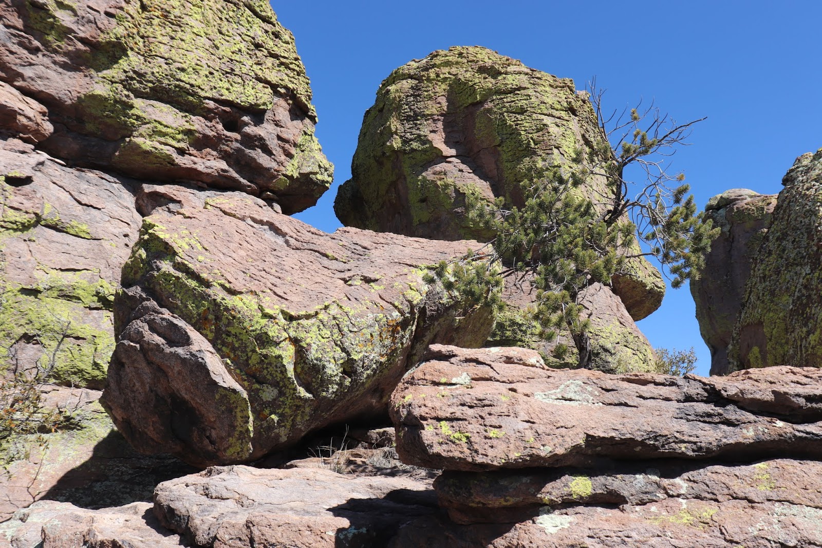
The “standing-up” rocks defy comprehension -- but so do the ordinary lying-down rocks. Thoughts of their origins and great age, the erosion that has created their present form over millenia, and the knowledge that millions more years will change them utterly from what they are today — all these things deepen the appreciation of anyone viewing their magnificence. What stories the trees could tell! Little lizards scooting about and sunning themselves probably think nothing of earth’s history, only of what they will eat next and how good the sun’s warmth feels.


There were parts of the trail where the wind was cold and biting, other parts, later, farther on, where we shed our jackets and basked in the sun like lizards. We enjoyed our lunch, for instance, in sunshine, and I never did put my jacket back on, as carrying it on my backpack, while burdensome, was the lesser uncomfortable choice. When my camera battery gave out before the halfway mark, I had to resort to my phone for photographs but took fewer even of those as we neared the elusive end of the trail. Luckily, the camera was still working when we saw before us this adventurous young woman on top of a high perched rock.

I could never attempt such a feat! Could I even make it all the way around the Loop? There is no alternative! Therese and I gave each other sour looks as a young jogger passed us on the trail. Show-off! “He’s only in his twenties,” Therese said to comfort me, as I insisted on yet another stop to rest and take in water. My hiking guide and companion, who knows the trail very well from years of experience on it, was very patient with someone old enough to be her mother. She was very happy that my enthusiasm, if not my energy, matched her own.

The rocks!


"Balanced" rock


Obligatory classic goofy pose
There were also cool, dark places, very welcome once the sun had warmed up the day. 


I was glad we did go all the way to the bottom of the trail, even though it meant having to go all the way back up, because thanks to all the rain and snow this past winter the creeks were running cold and fresh. This section of stream with a series of pools and miniature waterfalls was worth all the effort it took to reach it. 


The fact is, there were many people on the trail that day. It was a Sunday and spring break, and the weather could not have been more beautiful, so we let many parties of younger people go around us. One unexpected encounter with a couple from Quebec (while I was resting yet again) gave me a chance to speak French, always a spirit-lifter. But really, the scenery was spirit-lifting the entire time we were on the trail. We heard someone telling another person that the trail could be done in two hours. That annoyed Therese, who thought the estimate short of reality — and reality for us, because she had me with her, slowing her down, was that we were on the trail over four hours on Sunday.

Oh, the combinations of trees and rocks, each one more enchanting than the one before!


The farther along the trail, however, the more frequent my need to stop and rest, drink water and inspect every miniature landscape within sight, along with taking the long views outward. The last two-tenths of a mile, for me, seemed endless — or, at least I thought that was the longest, most difficult stretch, climbing ever upward (or should I say trudging?), until we were within sight of the parking lot again — and then I thought the last 200 yards were the longest distance I had traveled in my lifetime. 

Miniature landscape
But this old lady made it! She was not voted off the mountain but staggered on until the very end!

Of all the glorious and truly awesome views I took in that day, one that speaks volumes to me is this simple image of a manzanita sprawling and blooming on a large flat rock on the edge of the mountain. Its aesthetic Japanese, it is an entire landscape in itself and illustrates beautifully the plant’s tenacious perseverance, dogged survival, and adaptation to environment. 

One more thing I have to say. I kept thinking of Cochise and the other Chiricahua Apaches and how their homeland was stolen from them and they banished to, of all places, Florida. How could any people who called this place home ever be happy anywhere else? 


But also -- one more thing -- my hat is off to Betty Jones and all her miles and years of hiking and learning in the Chiricahua Mountains. Good job, Betty! I have a tiny idea now of the great lifetime you accomplished.