Search This Blog

Showing posts with label sky islands. Show all posts

Friday, March 17, 2023

No, Not Excavating, But Yes, in a Canyon


One of the most remarkable characteristics of the Earth is that the rates of its interior (tectonic) and exterior (climatic) processes are approximately balanced. Erosion can dismantle mountain belts nearly as fast as they grow. …No mountain is exempt from erosion, and the steepest slopes are subject to the fiercest attacks. 


-      Marcia Bjornerud, Reading the Rocks: The Autobiography of the Earth


We are once again in the Dos Cabezas Mountains -- right in our backyard, so to speak, “we” being Therese and I and our dogs, Yogi and Sunny. Therese has explored part of this territory before, long ago, but it’s completely new for the dogs and me. The open-looking ground in the lower left-hand corner above is, once again, what remains of a former mining road, and our hike will take us back into the picture, past that big tree on the left and eventually deep into a canyon we can’t see at all yet. What looks like a road high above on the right, below the rocky summit, is an old mining scar, but we’re not going there. We will take what remains of the old road paralleling a rocky wash, descend into the wash where rains have washed away sections of road, and explore the canyon not yet visible – because while the land looks quite open in this initial photograph, most of what we will encounter on the ground is still hidden from view, only gradually revealed as we penetrate farther into the picture.
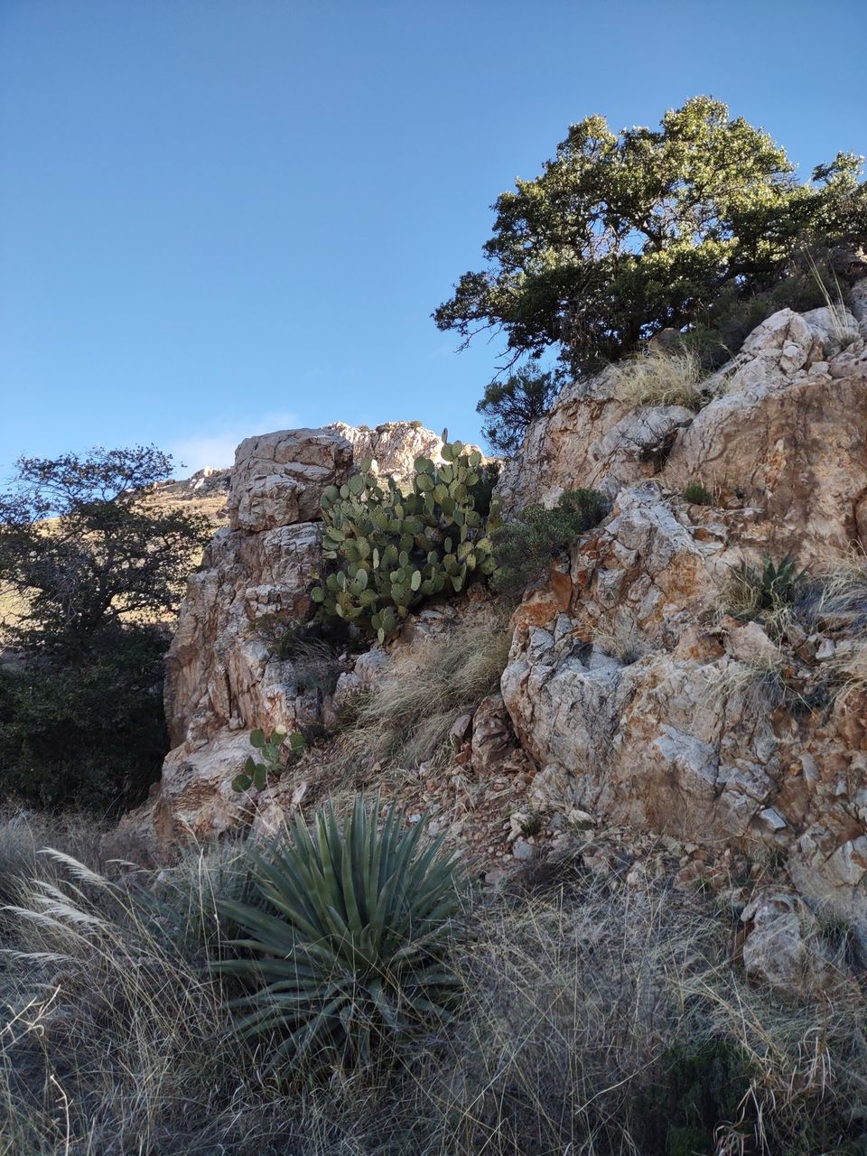


These massive, towering promontories, for instance, so close at hand! Did you see them coming?


The light, bright green plant in the foreground here is Mormon tea, Ephedra viridis. Early Mormon settlers to this region followed the Native American practice of making tea from the dried plant stems, for use not only as a beverage but also to treat colds. Commercial cold remedies are made from an Asian species of Ephedra; the Arizona species does not contain ephedrine, its effect derived instead from tannins.


Going is not fast or easy in a boulder-filled wash. Great forces were necessary to bring the boulders down in the first place, and yet not all monsoon floods were strong enough to keep pushing them. Sometimes the water had to go around the rocks instead, crumbling and eroding and bringing down soil from the banks of what was temporarily a stream to fill the bed with sediment and widen the whole course – except where the bed is bedrock rather than soil, and then the way remains narrow and rockbound.


We humans with our short lifespans and human-centric views of nature usually tend to think of erosion in negative terms, and yet structural geologist Marcia Bjornerud explains it as part of a constantly repeating cycle, the growth and erosion of mountain belts “keeping [the] planet on an even keel,” unlike other planets where volcanoes spew forth unchecked lava flows, growing and growing. “On earth,” she writes, “there are limits to growth, imposed largely by running water.” Bjornerud’s explanations and descriptions take her beneath the ocean, where sediments collect on continental shelves, but I’m sticking to the neighborhood at hand: mountains, rains, and periodically flooded washes.
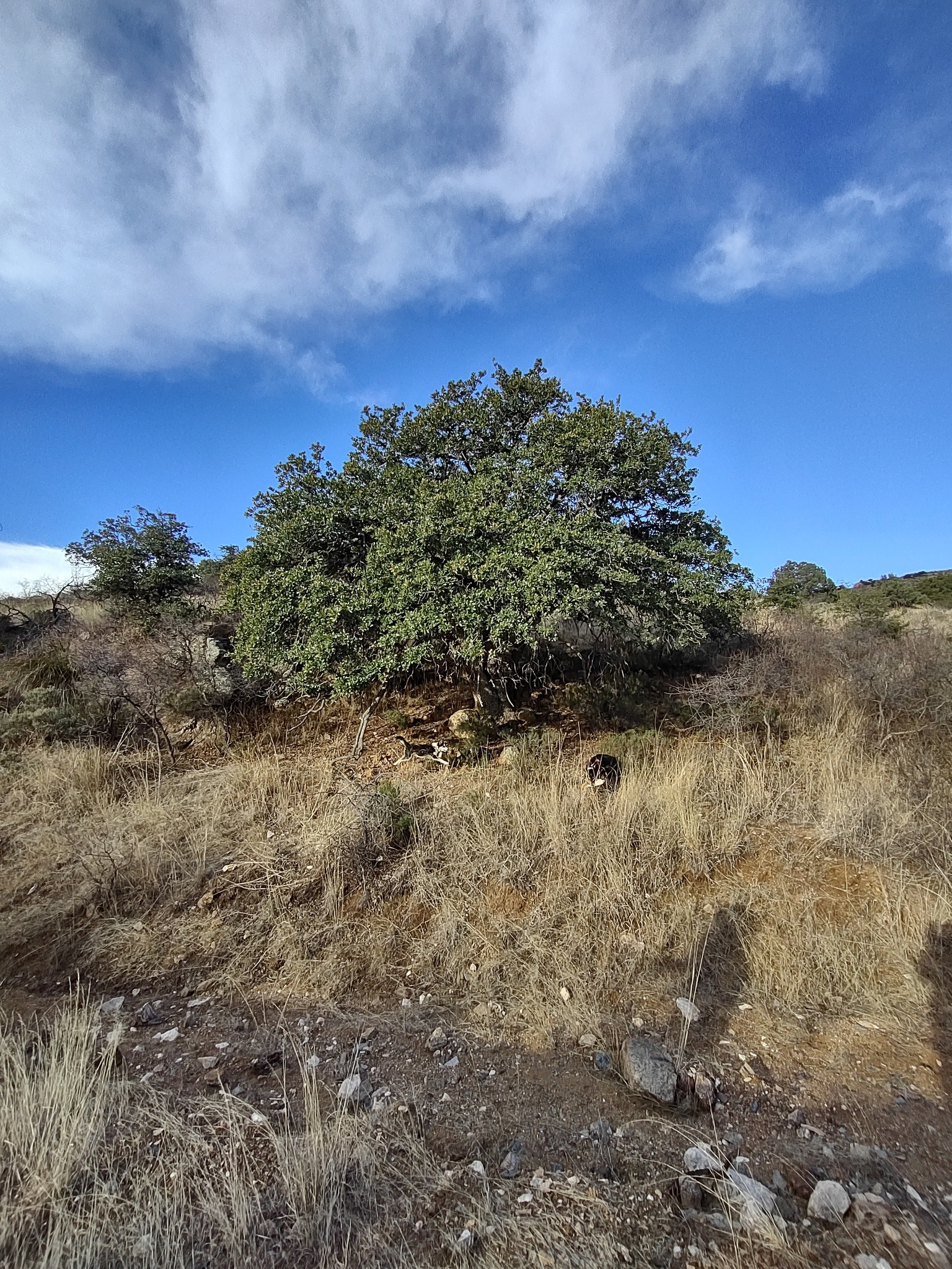


Sunny and Yogi’s interests are even more locally focused than mine. A bone! They have found a bone! Trust those dogs always to find something thrilling – and better a bone than partially decayed rabbit carcasses or bloody deer legs left behind by coyotes!


I wish you could see how this boulder really looked. It sparkled in the sunlight, but my phone photo does not capture the sparkles. 


Our course has altered by about 90 degrees now, and we are getting into the canyon we wanted to explore today. These views are looking back the way we came, through that sunlight into the background and into deep shade. 


It was exciting to come upon a pool of water. 


Later at home, examining topo maps, I decided we had probably been in Walnut Canyon, and had we gone farther up we might have come to Walnut Spring. Maybe. (We saw no walnuts.) Whatever the name of this rocky slot canyon, it is not anywhere you would want to be during a summer monsoon. As our way narrowed, with massive rock walls on either side, the cowpath and/or game trail became more and more what I would call a precarious goat path. But the rocks were beautiful! --If only I knew their names! That will be in my next life, when I begin in girlhood to prepare for a career as a horseback field geologist….


Our way came out into the sun again eventually, but boulders lay thicker than ever ahead, and we agreed to turn back and call it a morning.


One main theme I have taken so far from Reading the Rocks is that the history of the earth, like the history of the universe, is a story of alternate mixing and sorting. (That, in fact, is the title of one of the author’s chapters.) Stars explode, and eventually planets and their satellites settle out of the chaos. Volcanoes erupt and jumble things again, but in time the boulders and rocks and stones sort themselves out. Tectonic plates collide and give us a new reconfiguration of land and sea. Maybe we need periodic upsets in our brief, small personal lives, unwelcome as they often are, to give us reason to reassess and re-sort, finding a new (though always temporary) equilibrium. What do you think?


Be that as it may, another satisfying mountain expedition has whetted my enthusiasm for further adventures off the beaten path and provided food for thought to accompany my reading.


Tuesday, January 21, 2020

Just Out the Door and Down the Road


This morning’s sky confirmed the forecast I’ve been seeing on my phone for several days: we’re in for a rainy day — and that’s not bad. A day of rain now and then damps down the risk of fire, a good thing in the high desert. The prediction for the next nine days following today’s rain is for mostly sun with a few clouds. Today we're in for an all-day soaker. Fine.


We made an afternoon expedition on Saturday to the spectacularly beautiful Chiricahua National Monument, where crowds I expected to see on a holiday weekend were largely absent. Absent also (and this was a real blessing) was the strong, cold wind we normally encounter up on Massai Point. Although the air temperature kept dropping as we wound our way to the 6,870-ft. peak, and we saw increasingly larger patches of snow along the narrow, winding road, sunshine was absolutely glaring when we reached the high end of the road, and on a strategically placed bench, looking out over the astonishing hoodoos, across the 40-square-mile playa and surrounding Sulphur Springs Valley to the Dragoon Mountains seventy miles to the west, we were out of even the slightest breeze and content to soak up sun to our hearts’ content.


After five years, I’m finally getting some light grip on the geology of Cochise County, Arizona, and the sky islands of this basin-and-range country. At least, I think I am, but don’t quiz me. Instead, correct me if you think I’ve gone astray. 

To understand the formation of the Chiricahua range, we have to go back twenty-seven million years and the movement of tectonic plates those 27,000,000 years ago, when the molten core of the earth was much more active and closer to the surface than it is in Arizona today. Back then a dense oceanic plate of basalt was overridden by a lighter plate of granite (the North American plate, moving west in true though still prehistoric North American fashion), and as the resulting collision (friction?) increased both rock and water temperature, the former melted as it mixed with the already molten mantle. 

Just south of the Monument (which in itself occupies only a portion of the entire Chiricahua range) are the remains of what is known as the Turkey Creek Caldera. There a magma chamber broke through the earth’s crust and spewed burning gas, ash, and lava over 1,200 square miles in an explosion estimated to be five to ten times larger than the historic Krakatoa eruption in 1883. 

Turkey Creek is so calm and quiet today that it’s almost impossible to picture the nuée ardente — scorching rain! — that flew upward from the prehistoric volcano and flowed outward at over 100 miles an hour as a burning avalanche! In time, of course, the magma cooled and hardened, forming a rhyolite bedrock over eight hundred feet thick. And that and similar eruptions were the birth of the Chiricahua mountains.

But basin and range land is not created by volcanos alone. Once the dramatic volcanic events are over and plate movement slows down, everything gradually cools, and it is then that the cooling masses of rock, slowly but irresistibly, shove against each other, faulting, tilting, and lifting some segments up, while the surrounding basins sink. The creation of Arizona’s sky islands, then — these fault-block mountain ranges that rise up from a nearly level sea (though 4,000+ feet above sea level) of grassland and desert — was very unlike that of the folded Appalachians with their more gradual slopes. 


Nor, however, is faulting, tilting, and rising the end of the story, because subsequently comes the much slower action of weathering. Wind and water (in liquid and solid form) take starring roles in the weathering story but achieve their dramatic effects at very undramatic speed.
Formed by case hardening caused by the amorphous silica left behind after precipitated water evaporates off the surface of the rock formations, pinnacles in Chiricahua National Monument were formed by the freezing and thawing of water during the last ice age approximately ten thousand years ago. 
- William Ascarza, Chiricahua Mountains: History and Nature
Sculpted rhyolite makes for stunning scenes in Chiricahua, where jointed columns of rock invite “the entry of water, instigating chemical and physical weathering.”


Less spectacular but as much a part of the geologic story as the hoodoos are “solution pans” and “slot canyons,” the latter “forty times deeper than they are wide” (Ibid.).

We do not always think about it when admiring mountain hoodoos and the other rock formations we find so amazing, but weathering is a relentlessly ongoing process, continuing in our own age, day by day. Saturday there were pockets of snow in the mountains. As sun reached some of them, that snow melted, and meltwater sought out cracks through which it could descend to creeks and rills headed for the playa. Perhaps that ultimate destination would not be reached, but water would push its way along as far as possible, carrying with it occasional small bits of rock and stone. 


And on the other side of the mountain from where we found our sheltered bench, wind was doing the work it does night and day.


Because of weathering, all the sky island peaks have been worn down from their original height, and the valleys — recipients of eroded mountain material — have gained in elevation. Today’s rain is a geologic drop in the bucket, but each raindrop, each snowflake, contributes to the cumulative effect.


The Artist and I never view Chiricahua with jaded eyes. Every visit feels like the first time, so unusual and fascinating and mentally challenging are the sights. For me, though, the presence of tall, green trees is almost as exciting as the rock formations. Down in our winter ghost town we have only mesquite and netleaf hackberry, whereas in Chiricahua there are beautiful alligator juniper, Gambel oaks, Douglas firs, and stately Ponderosa pine. We are so very lucky, we tell each other, to have all this natural beauty practically in our backyard! It doesn’t even have to be a day trip: half a day gets us there, gives us time for a walk and a picnic, and gets us back to our own Dos Cabezas, which are, literally, in our backyard, so that coming back home at the end of the day is never a disappointment.


Back in Michigan, where we live maybe a mile from the glory of Lake Michigan, we don’t see the water from our windows, but neither do we pay lakeshore property tax or worry that rising lake levels will carry off our home. The closest road to the Lake is private, so we have to take a little ride to get to a beach, but it isn’t all that far, and on mornings after stormy, windy nights we can hear the waves from our front door. Thus it is well within our reach, that glory — even closer than it was when we lived in Kalamazoo and I occasionally needed a 100-mile evening round trip so I could walk on the beach to unwind after a day of work at a job I did not love.

I was lucky even in my girlhood, when the house my parents bought for our move from South Dakota to Illinois was on the last street of a subdivision, out beyond the city limits, with a working farm across the road to the west. How hungrily and greedily and gratefully, too, I watched thunderstorms and sunsets in that open expanse from our enclosed front porch! 

South Dakota, Illinois, Michigan, Arizona. Fields, lakes, desert, mountains. Just outside the door or maybe a little way down the road, open spaces and natural beauty have always helped me breathe deeply and filled me with peace.

Sources

1. Ascarzs, William. Chiricahua Mountains: History and Nature (Charleston, SC: Natural History Press, 2014)

2. Gilluly, James; A. C. Waters; & A. O. Woodford. Principles of Geology, 2nd ed. (San Francisco: W. H. Freeman & Co., 1959).


Friday, January 30, 2015

Climbing Into the Sky


Within the fixed limits of its allotted hours the sun is supreme. It does not yield to passing clouds, for much of the time there are none. Nothing can deny the sun’s omnipotence or detract from its authority. Step into its presence and you are flooded with light. All the world around you is immersed in its radiance. 
- Walter Collins O’Kane, The Intimate Desert
In the morning, we went to town (Willcox, that is) to do errands, winding up with coffee on the front porch of our regular coffee spot before coming home for lunch, so it was nearly midafternoon before we set off on our first visit to nearby Chiricahua National Monument. Only 21 miles from Dos Cabezas, the trip took us east of home on 186 for the first time.


It was exciting to see snow-capped mountains ahead in the distance and to know that was our destination for the day. Clouds – yes, that day there were clouds -- made constantly shifting dark shadows on the mountains and intervening seas of grass, the grass tall and golden under a bright blue sky like the coat of an immense animal covering many square miles.


We hadn’t gone far into the park when a roadrunner suddenly appeared and ran crazily along the road, zig-zagging in our direction, before disappearing again into the vegetation. At the visitor center, I mentioned it to the ranger, prefacing my reportage, “This probably won’t sound thrilling to you...,” but she said it was thrilling, because “we don’t get a lot of roadrunners up here.” More luck! And it kept coming, too, because Chiricahua no longer charges an entry fee. I put the money saved toward part of the price of a state road atlas from the gift shop. I like maps with detail, with every dirt road shown.

But this day was all Chiricahua. And here, in large part, is the text from the first informational sign we encountered:
The Apache called this area “The Land of Standing-Up Rocks”....  
Chiricahua resembles an oceanic archipelago – a sea dotted with islands – only here the desert is a hot desert grassland. We call these isolated mountain ranges “sky islands.” The Sonoran and Chihuahuan deserts, and the Rocky Mountain and Sierra Madre ranges all meet here. The convergence of these four homes makes the area unusually rich in biodiversity. 
Chiricahua National Monument was established in 1924 to protect the fantastic rock formations known as “the pinnacles.” In 1934 the Civilian Conservation orps began the job of improving the road and constructing the trails and many park structures, including the visitor center. 
In 1976 Congress decided to further preserve the land by designating 86% of the monument as Wilderness. This precludes any development and human intervention, thus ensuring the preservation of the geological formations for future generations. 
Another 6 miles along the Bonita Canyon Drive will transport you through oak, cypress and pine forests to the summit at Massai Point, where you will get a true sense of being atop a sky island.
And so we set off, up the mountain road. It was not at all easy to photograph the “standing-up rocks,” either with the light directly on them, so that they tended to be overexposed relative to surrounding sky and trees, or when they were plunged into deep shade and the sky behind them flooded with light. I thought Photoshop would save me, but success was elusive – limited, at best.


Also, as the road climbed more and more steeply, my anxiety got in the way of camera work, too. I kept asking David to slow down. He wasn’t driving fast, and he was driving very well; it just felt fast and scary to me. Lucky (again) that I hadn’t known ahead of time how terrifying the road up to Massai Point would be, with all those drop-off edges, or we might have missed some these heart-stopping long-distance views.


Again, sharp contrasts of light and dark made it impossible (for me, I should say; suggestions are welcome) to capture both nearby mountain rocks and lowlying background rangeland together. Try imaginatively to put together in your mind’s eye the two photographs above to see what we actually saw.

But we were really there, 6,870’ above sea level! Some peaks in the Chiricahuas, I should note, are higher than 9,000’, but almost 7,000 is as high as I feel the need to go!


Can you tell I was quaking in my boots? And doesn’t David look relaxed?


We met a couple from Louisiana, painters who now live in Benson, Arizona, not far from Willcox. David talked painting with them. Sharon and I compared geographical notes. Looking off in the direction I correctly identified as northeast, she told me we were looking toward the Gila range and New Mexico. The light in that direction was kind and gentle.


The name for the geology of this SE corner of Arizona is range and basin (yes, as in John McPhee’s book title), and I admit I’m more comfortable in the basins or in the foothill regions between basin and peaks. Coming back down from the dizzying heights, when I was able to look up at the rocks again and feel more comfortable, we found a picnic spot and caught our breath and ate apples and drank water and spotted an acorn woodpecker high in a tree. The acorn woodpecker is “common,” but it’s the first one I’ve ever seen, so it was thrilling to me, and I’m including its picture, despite the poor quality of the image.


The light was gentle as we left the mountains behind. We will return often to the Chiricahuas, I’m sure. It is very close and very beautiful. Also, there is a lot to explore at my preferred lower altitudes.


(Looking back)

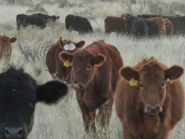
On our way back west, I wanted to stop to get a better look at some grazing “cows,” as all cattle (mostly steers) are called out here. When I got out of the car, the animals ambled over to the fence, seemingly curious.


All are curious and want to get in on the action!

Blue sky with clouds, golden grasses, a lovely new stretch of road with almost no traffic, a roadrunner, fantastic mountains, terror, delight, beauty, an acorn woodpecker, and cattle up close -- what more could such a beautiful, thrilling day offer, if not a spectacular sunset from our front door in Dos Cabezas?