Reading, Beforehand the Challenge
Back in spring of 2015, my hiking guide from the Dragoon Mountains adventure and I set out to explore the old Fort Bowie road, planning to hike in from the road to the ruins of the fort. Sadly, a flat tire and a long wait for road service (a “donut” tire would not have gone far in the mountains!) ate up much of the morning, and as she was no longer confident on the unpaved, washboard road, full of sharp rocks, we went back to the highway and continued southeast to Chiricahua National Monument. The biggest error of that day, though, was taking Sarah along. Let me say only: dogs on leashes — not good for hiking in mountains!
So this year, when my neighborhood dog-walking companion and I made a date to hike in Chiricahua, we agreed: no dogs! This was one adventure Therese and I would have without Buddy and Mollie and Sarah.
I was up before the sun on St. Patrick’s Day Sunday morning, with absolutely the perfect pre-hike reading, a copy of Range Roaming: A Birdwatcher’s 65-Plus Year Love Affair with the Chiricahua Mountains, by Betty Jones, published by the family after the authors death. I’d left off reading the night before at the end of the chapter just preceding the one on the Chiricahua National Monument, and so with my pre-dawn, pre-hike morning coffee I read about Betty’s camping and hiking and birding in the Monument itself (the Monument being only a small part of the entire mountain range), continuing after the sun had risen to the next chapter, on birding in Patagonia, where friends of ours wintered for years and where we visited them in their last year of life. That brought a few sighs, I must say, as I inspected the map closely to locate Jim and Linda’s house with respect to the creek we had forded to get there on our first visit back in the 1990s….
Range Roaming isn’t the easiest book to read or navigate, for a couple of reasons. One confusing feature is that the sketchy maps — and don’t get me wrong: I’m glad to have even sketchy maps — are not all presented in the conventional manner with North at the top of the page. In the various maps throughout the book, North can appear at the top, at the bottom, on the side; in other words, it might be anywhere. I kept turning the book around in my hands to put North at the top — but that meant trying to read the names of identified features (roads, paths, peaks, etc.) upside-down or sideways. As I say, not easy.
Another problem — for me — is that it’s obvious the manuscript preparation was not professionally done, and my inner editor and proofreader were working their fool heads off practically nonstop as I read. But that’s a personal comment, not a harsh complaint, because I am very happy to have this book, which is nothing like anything else I’ve seen on the area. It’s worth its cover price, even if the possessive its and the contraction it’s, among other little niceties of grammar and punctuation, failed to get sorted out before publication.
Many of the hikes Jones took are no longer possible, and neither can people still camp everywhere she did, as land open to her in the 1960s and 1970s is now off-limits to the public, but other trails and campgrounds are still available, and her descriptions of the wildflowers, birds, and butterflies a visitor might hope to encounter are enough to whet the appetite of the least-educated amateur naturalist. (In fact, I can’t help regretting in advance that I will not be able to explore Chiricahua in the summer, during the exciting thunderstorms and when the bright red flowers and the various species of hummingbird that feed on them will be on full display.) I also appreciate the history of the Monument lands included with the author’s boots-on-the-ground adventures. Reading of work accomplished by the Civilian Conservation Corps, for example, I think proudly of our older Minnesota grandson and his summer work along those same lines. And while I knew the Buffalo Soldiers had played a large role in the history of southeast Arizona, I did not realize before reading it in this book that they “briefly occupied the grounds on what is now the Faraway Ranch Historic District.” This is the kind of history that means the most to me — very local history of specific individuals and groups, such that I can picture a place I know and imagine the people working there over the years.
One distracting but delightful surprise to interrupt my reading was a roadrunner on the railing outside the front door! That was a first! They come in the yard, but I’ve never seen one on a railing before. Of course, my camera was not near my reading chair, and the roadrunner fluttered down and ran down the driveway before I could try to capture the moment.
And Afterward!!!!!
 |
| Entering the Monument: Mule deer grazing |
Words cannot do it justice, and photographs cannot hope to get across the wonder of Chiricahua, but words and photographs are all I have.
The map above comes from William Ascarza’s book, Chiricahua Mountains: History and Nature, an excellent general introduction to the mountains, though without the personal tone and on-the-ground detail of the Betty Jones book. As you no doubt are thinking, the Echo Loop trail (just to the left of Massai Point) as it appears on the map doesn’t look like much of a challenge. It seems to take in a very small area of the Monument, which is itself only a small portion of the Chiricahua Mountains. A mere three miles? That’s the official distance given for the trail. A walk in the park, you say? Ah, but the first half of the hike is all descent into the canyon, the second half a return up-mountain to the parking lot, with absolutely no possibility of cutting the mountain goat hike short once you have committed to its entirety by reaching the lowest elevation. There are no roads down there, and the only way back is up, on foot.

Hikers who have commented online occasionally dispute the 3-mile official distance. One measured the Echo Loop hike as 4.1 miles, another as 4.3, and Therese warned me it would feel like at least four miles. I thought it felt more like eight — but then, I am in my eighth decade of life, and that probably makes a difference.
Ah, difference! Difference in elevation is what really makes the challenge, and that you don’t see on the trail map. Officially, again, the change in elevation from top to bottom is given as 554’, but again, at least one hiker’s family was sure they had descended and reascended 750’ on the Loop. But I should add that Echo Loop is the Monument’s most popular trail, and no one who left a comment online failed to note its beauty and grandeur, i.e., no one was complaining! And I’m not, either, just kind of bragging, I guess, though younger, sturdier, most experienced outdoor adventure people don’t see this hike as bragging material.
 |
| Horses were here... |
Okay, here’s a bit of what it’s like. The trail is narrow for almost its entire length, with dizzying drop-offs to the side. A few stretches have stone steps built in, others are loose rock and scree, while occasionally dirt or mud (there was a lot of precipitation this past winter) registered prints of horses’ feet. The evidence of horses on the trail amazed me, all the more the farther we went. The horses had done the entire trail, stopping to refresh themselves at the creek near the end. I kept thinking of the horse named Whiskey in the movie “Lonely Are the Brave” and told Therese she has to see that movie.
 |
| ...on this very narrow trail! |
(What would it be like to travel Echo Loop on horseback? It is difficult enough to take in all the scenery. A hiker has to watch his or her footing pretty continually, for starters, but one wants to inspect closely the beautiful lichens and weathered dead trees close at hand, as well as — of course! — looking up at the magnificent hoodoos and out across the long vistas that are sometimes all rock, sometimes forested slopes, occasionally a glimpse back down into the Sulphur Springs Valley. If, in addition to these desires, were I on horseback I would also have the distraction of wanting to pay attention to and praising and encouraging my brave, wonderful horse. It might be too much for me.)


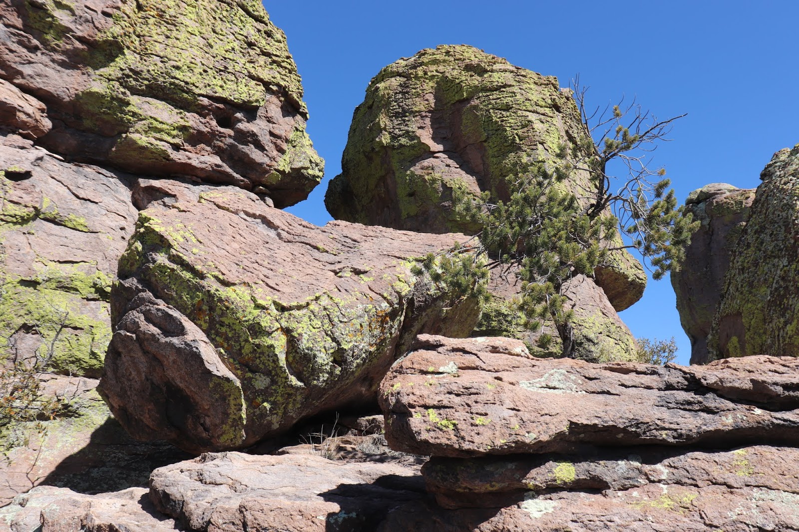
The “standing-up” rocks defy comprehension -- but so do the ordinary lying-down rocks. Thoughts of their origins and great age, the erosion that has created their present form over millenia, and the knowledge that millions more years will change them utterly from what they are today — all these things deepen the appreciation of anyone viewing their magnificence. What stories the trees could tell! Little lizards scooting about and sunning themselves probably think nothing of earth’s history, only of what they will eat next and how good the sun’s warmth feels.


There were parts of the trail where the wind was cold and biting, other parts, later, farther on, where we shed our jackets and basked in the sun like lizards. We enjoyed our lunch, for instance, in sunshine, and I never did put my jacket back on, as carrying it on my backpack, while burdensome, was the lesser uncomfortable choice. When my camera battery gave out before the halfway mark, I had to resort to my phone for photographs but took fewer even of those as we neared the elusive end of the trail. Luckily, the camera was still working when we saw before us this adventurous young woman on top of a high perched rock.


I could never attempt such a feat! Could I even make it all the way around the Loop? There is no alternative! Therese and I gave each other sour looks as a young jogger passed us on the trail. Show-off! “He’s only in his twenties,” Therese said to comfort me, as I insisted on yet another stop to rest and take in water. My hiking guide and companion, who knows the trail very well from years of experience on it, was very patient with someone old enough to be her mother. She was very happy that my enthusiasm, if not my energy, matched her own.
The rocks!
 |
| "Balanced" rock |
 |
| Obligatory classic goofy pose |
There were also cool, dark places, very welcome once the sun had warmed up the day.
I was glad we did go all the way to the bottom of the trail, even though it meant having to go all the way back up, because thanks to all the rain and snow this past winter the creeks were running cold and fresh. This section of stream with a series of pools and miniature waterfalls was worth all the effort it took to reach it.

The fact is, there were many people on the trail that day. It was a Sunday and spring break, and the weather could not have been more beautiful, so we let many parties of younger people go around us. One unexpected encounter with a couple from Quebec (while I was resting yet again) gave me a chance to speak French, always a spirit-lifter. But really, the scenery was spirit-lifting the entire time we were on the trail. We heard someone telling another person that the trail could be done in two hours. That annoyed Therese, who thought the estimate short of reality — and reality for us, because she had me with her, slowing her down, was that we were on the trail over four hours on Sunday.
Oh, the combinations of trees and rocks, each one more enchanting than the one before!


The farther along the trail, however, the more frequent my need to stop and rest, drink water and inspect every miniature landscape within sight, along with taking the long views outward. The last two-tenths of a mile, for me, seemed endless — or, at least I thought that was the longest, most difficult stretch, climbing ever upward (or should I say trudging?), until we were within sight of the parking lot again — and then I thought the last 200 yards were the longest distance I had traveled in my lifetime.
 |
| Miniature landscape |
But this old lady made it! She was not voted off the mountain but staggered on until the very end!
 Of all the glorious and truly awesome views I took in that day, one that speaks volumes to me is this simple image of a manzanita sprawling and blooming on a large flat rock on the edge of the mountain. Its aesthetic Japanese, it is an entire landscape in itself and illustrates beautifully the plant’s tenacious perseverance, dogged survival, and adaptation to environment.
One more thing I have to say. I kept thinking of Cochise and the other Chiricahua Apaches and how their homeland was stolen from them and they banished to, of all places, Florida. How could any people who called this place home ever be happy anywhere else?
But also -- one more thing -- my hat is off to Betty Jones and all her miles and years of hiking and learning in the Chiricahua Mountains. Good job, Betty! I have a tiny idea now of the great lifetime you accomplished.