Search This Blog

Friday, February 20, 2015

Looking at It From the Other Side


?  ?  ?  ?  ?

Do you believe there are two sides to every question? Sometimes I think there many more, and often (though not always) I see one way of looking at a question as yielding a much fuller explanation than “the other side.” The question I raised the other day, however, was no metaphysical dilemma. Is there water at present in some part or parts of the Willcox playa? The answer would clearly be a fact, and the fact is now in my possession! But first, another story....


We were coming home via side roads from a little expedition over to Benson and, on the way, our first but long-planned visit to the Amerind Museum. (The Museum merits a post all its own, but owing to what came afterward it will have to share the limelight today.) The Amerind is a private museum of Native American archaeology, founded in 1937 by William Shirley Fulton, and its collection houses pieces from both North and South America, those from prehistoric sites as well as modern Native American art and culture. Associated with the museum is the Fulton-Hayden Art Gallery.


No photographs may be taken in the gallery, understandably, but I did take a few non-flash shots in the museum.


...


David was exceptionally taken with the natural setting of the museum, situated in spectacular Texas Canyon, home of eye-popping balanced rock formations. Texas Canyon is home to giant igneous rocks weathered over time, similar to those in Chiricahua National Monument, but differently shaped. In Texas Canyon, the magma never quite broke through the surface as it did in the Chiricahuas, and Texas Canyon is also at a much lower altitude and without (as far as I could see) any significant stream action. So while Chiricahua is known for its columns, Texas Canyon is known for its balanced rocks. A brochure on the area geology makes the point that these formations are “relatively young” but that, even so, the dinosaurs had already been extinct for 10 million years before these rocks were formed. I wonder how long it took for them to achieve their present shapes and positions.


And now long has this old, twisted tree been growing here, and did it force its way right through a boulder?


Well, we’d already been to Lenore’s bookstore and the Amerind Museum and the adjacent art gallery, and we had enjoyed our little picnic of raisins and almonds and water surrounded by fantastic rocks (and no other picnickers!), so we were already satisfied with the day on our way back home. 


We took Dragoon Road over to 191 and turned north toward Willcox. And then, just past the power plant, I saw a sign for a wildlife viewing area! On the west side of the playa!


We followed the road in and climbed up to the viewing platform. There was water! There were birds! How satisfying! And I must confess, I felt vindicated, which can be a pretty good feeling, but seeing water is the best feeling, for someone from Michigan.


Highway 191 up to I-10 takes the high road, so to speak over the railroad line, and from the elevated vantage point it is possible to verify that the train line does, indeed, as indicated on maps, cross a corner of the playa. How I would love to ride that section of track!


Well, what a day it was -- and yet, I was torn about whether or not to post this story and these images at all because I am so excited about my next post that I can hardly wait to share it!


Wednesday, February 18, 2015

Just Beyond Our Reach


Every day it’s out there, tantalizing us in its nearness and teasing us in its remove. We drive past, too far beyond the perimeter to have a good, clear look at the great, white, dry, ancient lakebed. We strain to see farther. I try the zoom function on my camera, and we even stop to employ binoculars, but we are continually and at the same time enchanted and frustrated.

The playa! Magic word, magic name, mysterious presence! Maps say “Willcox playa,” and one book I read called it the "Willcox dry lake," but around here it’s simply “the playa,” because there is no other. And truly, you’d have to do some traveling to find anything like it.


Twelve to fifteen thousand years ago it was a lake. Lake Cochise, as geologists call it, retrospectively. Today the ancient lakebed holds water only intermittently and never, I’m guessing, in its entirety. But then, questions of when and how much water might be found out there are part of its mystery, as far as we are concerned.

One day we were driving north on Rt. 191, coming home from a little jaunt, and both of us swore we could see water out on the playa. I have sworn the same from Rt. 186, David receiving my avowals with skepticism. From 186 the water – well, the water I claimed to see, if it is there at all – the water is (or was – or was not) much farther from the road than what we were sure we saw on the other side. My sentences reek with doubt, I realize. The playa is said to hold “shallow, ephemeral ponds,” a phrase that encourages my belief, especially considering two recent days of steady rain. And yet, another source warns that distant blue mirages have fooled many a viewer before me! There is definitely standing water in pools closer to the road, but what was I seeing out beyond the grass, that sparse desert rangeland where cattle graze? Water or mirage?

One day I read of a wildlife area on the western edge of the playa, accessible from the Kansas Settlement Road, and with high hopes we set our course in that direction. Ah, but remember that the playa is the lowest portion of a low sediment basin surrounded by mountain ranges, and that when down on a flat surface one can hardly see through standing brush. Also, I must confess, the day we tried this was the only day we had no water with us! I’d taken the bottle into the house to refill and forgotten to put it back in the car. (Lesson learned!)


The sun was blazing, with no shade along the sun-baked trail. We walked over half a mile on dry, caked mud until we could finally see the bare, white, open expanse stretching ahead, very far ahead still. Alas! Every step taken would have to be retraced coming back, and we were sadly unprepared. No drinking water with us! -- And no tripod, either! (I will never be a serious photographer as long as I remain so as lazy as I am about tripods.) Well, what do you see in that wobbly, unfocused distance? Water? Mirage? And can a camera capture a mirage, or is a mirage, like an hallucination, the combined creation of an eye and a mind? 


The playa is said to be 40 or 50 square miles in area, depending, it seems, on who is doing the measuring. The area is not entirely open to the public, either, as it is full of – frightening words! – “undetonated ordnance” from its days as a test bombing range. To my surprise, however, I found online an illustrated account by someone who had been out there on a motorcycle. Perhaps certain parts are fenced off and other parts open? We may never get far enough out to answer that question. Perhaps we will keep it as a mystery.

The Willcox playa is cousin, in a manner of speaking, to the Great Salt Lake, both formed in the Pleistocene Epoch of the Quaternary Period of the Cenozoic Era. In geologic time, that’s recent. But sometimes, as we descend from the 5,082-ft. elevation of Dos Cabezas to 4,187-ft. Willcox (compare to Tucson at 2,584’ and Northport, Michigan, at 628’), we make an illegitimate imaginary collapse of the Jurassic, Cretaceous, and Quaternary periods and imagine the playa as lake home to giant thunder lizards, guzzling aquatic greens in the shallows and thrashing ponderous tails as they feed. It isn’t much harder to picture that scene than it is to envision Dos Cabezas as home to a bustling population of three thousand, a community served by school and railroad and post office, and numerous stores of various kinds.


Like the playa, the past here seems very near and at the same time tantalizingly and frustratingly just beyond our reach.

Look here for more (much better) images of the Willcox Playa.

Today’s book recommendation: The Coyote: Defiant Songdog of the West  (revised & updated, by François Leydet. Informative and compellingly readable.

Saturday, February 14, 2015

Little Adventures of Ordinary Days


We don’t go on long expeditions every day. Sometimes we have a day of simple errands in town and then come home to read and write. But even those ordinary days hold a drive to Willcox, which means a cruise through beautiful mountain views and past the mysterious Willcox Playa, an old lakebed from Pleistocene days, which I’ll write more about another time. Anyway, I get a lot of pleasure from our daily routines. Away from home, they take on an exotic air to me, although we, of course, are the exotic ones in this winter landscape.


First, the post office, where everyone there has been friendly and helpful from Day One. And now that we have a p.o. box, with our very own keys, I feel like a citizen of the desert when I unlock the box to look for mail every morning. Best of all, sometimes there’s mail in the box! I love that! Today, though, the box was empty. And Monday a holiday! I am momentarily crushed by disappointment but then tell myself I'll have a longer time for anticipation to build....


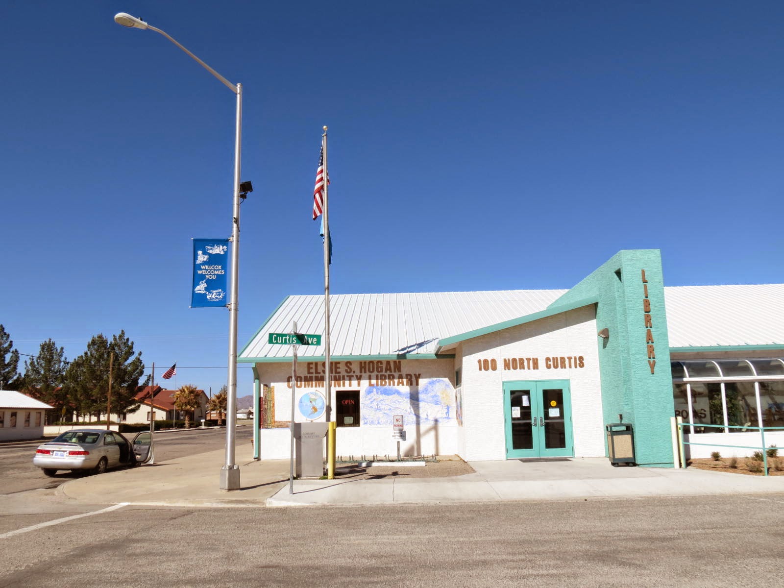
Most days we also go to the library, just one block from the p.o., where we check out books and movies, chat with the librarian, and where I update my blog and read new e-mail. It’s a very friendly library and has a wonderful large Arizona section and another large section of books in Spanish. (Unfortunately, I would not get much out of a book written in Spanish. Even the Spanish-language television programs go too fast for me to follow. A word or a phrase here and there is the best I usually do. If I get a whole sentence, I feel triumphant.) Naturally, the library also has computers of its own for patrons and the latest newspapers. The library is open every day but Sundays and holidays.

We go to Benson about once a week and have made three shopping expeditions already to Lenore’s wonderful bookstore, the modestly named Paperback Recycler, but Willcox has its own little bookstore. Run by the Friends of the Library, the Friendly Bookstore is not big or fancy and doesn’t have a curated collection, but it lives up to its name, and we usually find something to carry home. 


The first day of the 10-cent sale in the alley, we found many treasures! And yes, the bookstore really does sell local honey and jam. On the day of our first visit, I’d chosen jars of prickly pear jelly and catclaw bush honey for purchase and carried them to the counter before we even realized that the beekeeper himself was the volunteer clerk that day. We learned a lot about the agriculture of the region in conversation with him. Meeting new, interesting people far from home counts for an adventure in my book.

Before returning home, we always stop for coffee on the shaded porch across Railroad Avenue from the old train station. The business is a coffee shop, ice cream parlor, antique shop, bookstore, and more. There is a resident cat, and her name is – Sarah! There’s an old woodstove in the back, warming the indoors on chilly mornings. Our own Sarah is welcome to sit out on the porch with us and is always greeted by name by the genial proprietor.


(In my dreams, this is me.)

Coffee shop Sarah

From the porch we look across the street to the former handsome old restored train depot, now City Hall, and watch long freight trains roar through the crossing, and when we look off into the distance we see our “home” mountains. Sometimes a livestock trailer pulls up to park out front, and sometimes it holds horses and sometimes cattle, and sometimes cattle and horses, and one time one cowboy had cattle and horses and dogs – a fully-equipped cowboy outfit! Don't it turn my blue eyes green!

Horses

Border collie

Aussie

One day we had lunch down the street at Rodney’s, sitting out front with him at the sidewalk table. When the weather warms up, his patio garden out back will be shady and cool for dining. I had BBQ and beans and asked Rodney what kind of beans they were. Pinto beans, of course. Pinto beans are the beans around here. Rodney says the secret to good beans is that once they’re cooked, you never let them cool. Kind of like a French pot-au-feu, the bean pot should always be kept warm, and that way the beans stay soft and tasty. 2/15 addition: I found the cute photos of the guys that I couldn't locate the other day. Here they are:


Nearby is the old Willcox Historic Theatre, where we went recently to an evening concert given by the high school jazz band and had a wonderful time. We may go to see "Figaro" this coming week. I'll let you know if we do. Sadly, the night we went to the student concert, I left my camera at home and thus missed a killer panoramic sunset on the way to town, as well as great photo opps of all the musicians onstage. Lesson learned?


Sometimes we take a detour off the road home to see what’s happening at Willcox Lake. There are usually ducks and grebes paddling around on the water, and “my” loggerhead shrike may be perched near the water’s edge. Once a whole flock of sandhill cranes came flying in. But even without cranes, there are cattle grazing in the near distance, and it’s a lovely, peaceful scene.


I have omitted the grocery store from this litany of errands, although one of the two large grocery stores out by the expressway is quite fascinating to us, with its array of Mexican foodstuffs and an entire aisle of colorful piñatas, but will go back into town to close with the laundromat, because right next door to it is a little food truck that sells Sonoran-style hot dogs. Hot dogs not mean much to you? Didn’t mean much to me, either, until we tried them and found out what “Estilo Sonora” means: smothered in beans and sauce and hot peppers!

Sarah, we’re not in Michigan any more!


Monday, February 9, 2015

The Making of a Ghost Town


If mountains are formed by forces without intentions, and towns are planned and built by men and women, the ghost town might be seen as a hybrid creation, intentionally planned and built by human beings and then taken over by nature and entropy. No one plans to build a ghost town.

Dos Cabezas, Arizona, began its life as Ewell’s Station, sometimes called Ewell’s Springs, in 1858 as a stop on the Butterfield Overland Stagecoach line. Richard Stoddert Ewell, who grew up in Virginia, was a Second Lieutenant of the First United States Dragoons, stationed in the Southwest in the 1850s, resigned from the U.S. Army in 1861 to join the Confederacy. A Confederate cavalry lieutenant, he distinguished himself in the Civil War, dying in Tennessee at the age of 55. The first post office at Dos Cabezas (1879) bore that name rather than Ewell’s.

Phyllis de la Garza, in The Story of Dos Cabezas, writes of the nineteenth-century stage coach:
The coaches traveled about 120 miles each twenty-four hours, with stops at twenty miles apart. Bad weather, choking dust, marauding Indians, poor food, overturned coaches, continuous lurching and clattering, and an all-too-closeness with fellow passengers soon eliminated anybody’s romantic notions about traveling by stage. Occasionally a distraught passenger would leap stark raving mad from a stagecoach and run away into the wilderness, never to be seen again.
Stage coach travel continued in these parts until the arrival of the automobile. (The one below may be one of the earliest, do you think?)


It took more than a stage stop to establish a town in the high desert, but that seems to have been the start, promising enough that by 1888 fifty people were calling Dos Cabezas home, and the little town boasted a dry goods store, blacksmith, wheelwright, and carpenter’s shops, express and telegraph, barber, three livery stables, two saloons, grocery stores, butcher, hotel, and a private stage line office (de la Garza, p. 15). Homestead claims were filed, and men went into business making adobe  bricks for all the new buildings going up. There was hope of a mining boom in the offing. The vision for the region’s future was ranching and mining.


The Bear Cave Mine, located north of town in 1877, produced $40,000 in gold. The 1880s saw Silver Cave and Greenhorn mines in operation, and the Philadelphia mine had nine employees in 1894, and other claims and mines followed, but the gold and silver that came out of the hills was small stuff. Big stuff – or at least the initially appearance of big stuff – didn’t come until the 20th century, with the establishment of the Mascot Copper Company.

Thomas Newton McCauley was a piece of work. Hailed as a “business genius” in his forties, he came to the Southwest for his health but brought along a mining engineer, so as not to miss any opportunities his new home might offer. Soon McCauley was buying up claims, which he eventually incorporated as the Mascot Copper Company, with headquarters in an adobe house in Dos Cabezas. A board of directors was formed and construction begun. Obviously, investors would be needed. After losing a couple of years (1907-1909) to financial panic, the company charged full steam ahead, buying up additional claims. No one thought much any more of finding gold or silver. It was all about copper now.

McCauley really did seem to be a genius when it came to finding investors, and the company’s mining facilities were impressive. All out there in the “middle of nowhere,” so to speak. This is the way the author of The Story of Dos Cabezas describes the countryside:
The area surrounding Mascot Canyon was overgrown with broom bushes, desert willow, cholla, agave, hackberry and chokecherry bushes, black and white oak trees, satol [sic], Arizona sycamores and rosinweed. Narrow winding trails angled away from the main road leading into the hills where people searched for firewood, hunted, or busied themselves after 1914 in more clandestine activities such as operating bootleg stills. Canyon wrens flicked through the razor-sharp bear grass, hawks whistled and banked in the sky, deer, bobcat and javelina scattered noiselessly – their wild mountain disturbed by human activity. Prior to this only small prospect and mining claims dotted the Dos Cabezas hills.
Bootleg stills are beside the point these days, but the rest of the description fits 2015 pretty well. 

And yet, for a brief period in Arizona history, the picture of the area was very different. There were schools with growing student populations in Mascot and Dos Cabezas, and the mining valley was home to a large community hall, theatre, stores, dormitories, boarding houses, two restaurants, and more. The year 1915 had seen a railroad constructed between Dos Cabezas and Willcox, Arizona, and in 1920 new mine was opened on the other side of the mountains at Elma, with a tramline and yet another school. It was boom times for Dos Cabezas and the entire area. “Prosperity Day” was celebrated on October 10, 1925, in Willcox, but 1926-27 “marked the final grasp at prosperity by the Central Copper Company” (de la Garza, p. 157).

At the high point of mining operations, the Central Copper Copper Company, “a co-operative development ... almost entirely financed by wage earners,” as reported in the Arizona Mining Journal, had around 800 employees, and the population of Dos Cabezas was said to be over 3,000. Hard to believe today, but the Crash of 1929 came a year earlier in this little community in southeast Arizona. Again, to quote Phyllis de la Garza:
The mine was not a producer. It never was. They knew it had been a front, and yet, there was always that possibility, however slim, that a bonanza strike would be made.
A scam, a swindle? On such a large scale over so many years? Guests brought to view the operation, in hopes they would invest, were shown extensive above-ground facilities – power plants, mills, crushers, etc. Underground they viewed an impressive ore vein, but it was said that the same vein was shown twice, from different directions, as if it were two different veins, and that that ore was never mined but kept intact as an exhibit to attract investors. Some ore was shipped, of course, but very little compared to forecasts that were made. Amazing that “prosperity” lasted as long as it did!

T. N. McCauley went on to a high-rolling banking and development career in Tucson. Funny how men like that always land on their feet. The rest of the population of Dos Cabezas drifted away gradually, until only a dozen families lived here in the 1950s. The school closed in 1953, the post office in 1963, neither to be re-opened, as of 2015.


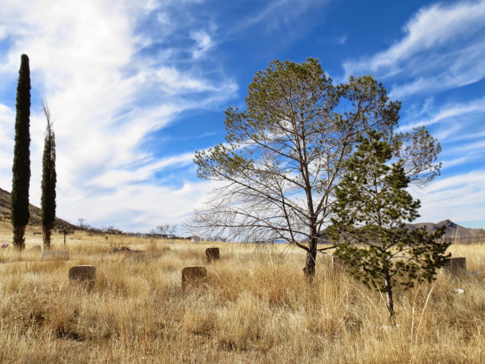
About the only thing “town”-like about Dos Cabezas these days is the cemetery. A neighbor told me that there is a community cemetery cleanup day and potluck once a year. “Other than that,” he said, “people pretty much leave each other alone.”

Surprisingly, there never was, in all its history, boom days and all, a church in Dos Cabezas. Some ladies established a Sunday School briefly for the children, but there was never a church. The same neighbor who told me about cleanup day at the cemetery pointed out a cross on top of a hill to the south. I hadn’t picked out the cross before but now spot it easily when I look to the top of that hill. “Our family used to walk all the way up that hill every Easter morning,” he told me. In the same book from which I’ve gathered and quoted most of the material in this post, I find the author mentioning that cross and clearing up the mystery of its origin.
On May 3, 1935, a cross was planted by a traveling Franciscan missionary who led his followers up the rugged hill overlooking Dos Cabezas during El Dia de la Santa Cruz celebration.

You probably can't see the cross in the first photo below, although it's there, up on the highest hill. 


One day as we were driving to Willcox to collect our mail, I spotted another obvious landmark that had escaped my notice until then, and now we look for it every time we travel that road. It’s the old railroad bed, still visible after all these years. 


It’s common around Dos Cabezas to see old railroad ties used as fence posts, too.

An old railroad bed, old railroad ties, crumbling adobe. A cemetery on a gentle slope and a cross on one high hill. A few rusted vehicles. These constitute the ghost town visible from the public thoroughfare. (More is hidden away on private property, inaccessible to the public.) The other side of the story, also visible, is to be seen in the modest, well-kept homes of oldtimers or newcomers. A ghost town is a very peaceful place to live. I like it pretty well myself.