Search This Blog

Sunday, February 24, 2019

“This Changes Everything!”


Snow, that is. We’re from Michigan and have seen lots of snow, and we’ve seen snow before in Arizona, too, both in the winters of 2015 and 2018 and now again in 2018-19. But when the forecast for last Friday promised “severe weather,” with possible accumulations of up to 22” at our elevation, that out of the ordinary. So when I got up Friday morning, then, after a night of wind and rain, I’ll admit I was disappointed to see not a snowflake in sight. The temperature was dropping, however — not what temperature generally does here between 6 and 8 a.m., but drop it did — and by 8:30 the rain at last turned to snow, and the white stuff came down nonstop all day. Well, down and sideways and sometimes even up. 

Wash behind cabin on Friday morning
We didn’t even walk down to the mailbox that day, let alone start the car and drive to town. Instead,  except for meals and a couple of dog sorties, we had quiet hours of reading and conversation — also lots of looking out the windows, on my part.

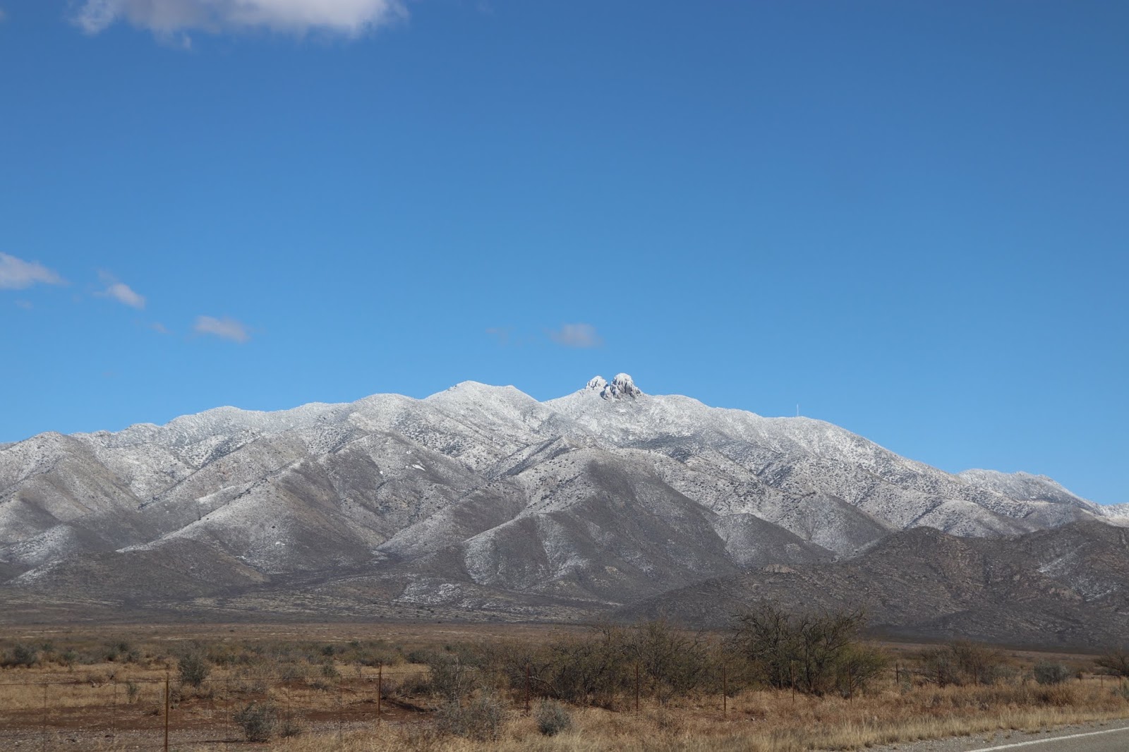
Saturday brought another blue sky morning, with bright sun shining down not only on snowy peaks but also on white mountainsides and snow-filled washes, every branch and twig of mesquite bearing its tracery of snow. I don’t know how long I stood gazing, mesmerized, at the south-facing cabeza, the one we see from the cabin, watching it disappear into and reappear from the clouds, changing moment by beautiful moment. 


The gentler rises, the ones without dramatic rocky peaks, were transformed by snow, as well, their basic structures, contours, and stegosaurian ridges made more readily visible and obvious by the contrast of dark and light.


Mountain folds were softened, shadow effects made sharper. Overwhelmed on our drive to meet a friend in Willcox, and knowing the snow effects to be ephemeral, I couldn’t turn my head quickly enough to take it all in.

Then, the Artist and I couldn’t help but think: if mountains we knew as everyday neighbors were so breathtakingly and dramatically changed by snow, what would the always dramatic Chiricahuas be like on such a day? And how many opportunities would we have to answer that question for ourselves? Would there ever be such another winter snow in southern Arizona for us? Maybe not. And so we set out down the road toward the Chiricahua National Monument, a road that never fails to please and even to thrill on the most ordinary of days, which this was decidedly not.


Oh, those ancient, majestic sycamores! What must it be like, ranching in such grandeur?


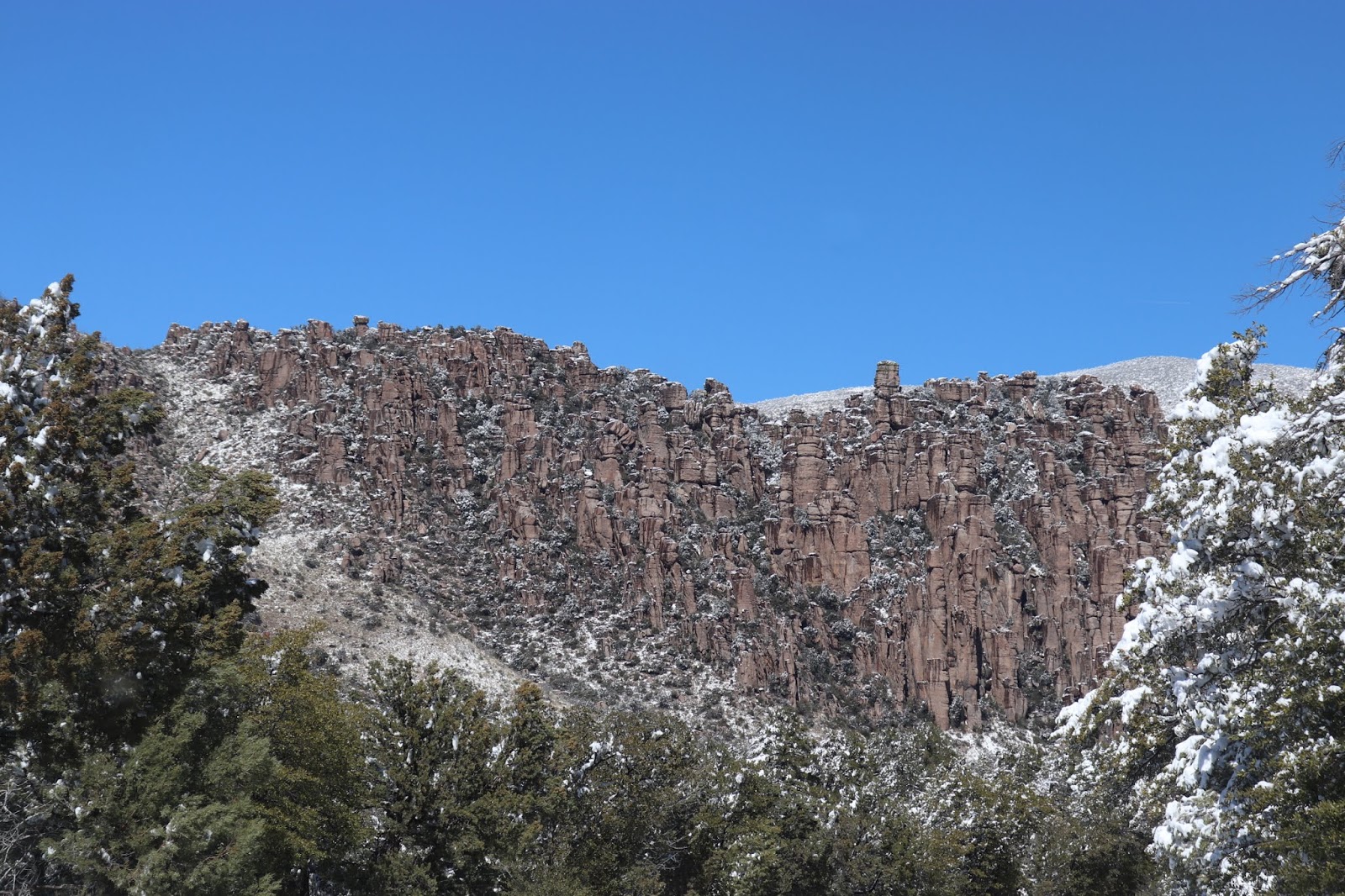

I was not disappointed that the road up to Massai Point was closed. The excitement of narrow, shoulderless, icy mountain roads I do not require. Anyway, we still had loveliness to encounter, by taking the road south from the monument to “go around the block,” the long way home, stopping to admire trees sparkling with snow in the washes. 


I’ve altered my final image for the day, a shot of Dos Cabezas as we neared home again, taking out the color to leave only black and white and shades of gray. The result, I think, emphasizes what snow does to highlight mountain contours. By late afternoon when this shot was taken, the snow had melted on the lower slopes. There was not a cloud in the sky, but see how the mountain makes its own shadows with a little help from the sun? Sufficient unto itself.

One more thing: I am currently reading John McPhee’s Rising From the Plains, which tells the story (among others) of the formation of Wyoming’s Rawlins Uplift and the formation of the Medicine Bow and Snowy Mountains, and not for the first time I am frustrated at not having the complete story of the origin of the Dos Cabezas Mountains. The Grand Canyon story is well told and widely available. The Rocky Mountains garner plenty of attention. The Chiricahua National Monument has brochures and books explaining the volcanic beginnings of that range of southeast Arizona “sky islands.” But more and more I realize that one story does not explain all mountain ranges, that every range has its unique history not duplicated exactly anywhere else on earth. And I want to know the history of my mountains, as well as that of others in the neighborhood. It occurs to me that if I were obscenely rich, I would commission a whole staff of geologists to research and publish the history of every mountain range in Arizona. What a project that would be! The first installment, though, would have to be the Dos Cabezas Mountains, because I am not living in the scale of geologic time and can’t wait ten million years. 

…The Teton landscape contained not one the most complete geologic history in North America but also the most complex. …After half a century with the story assembling in his mind, he [geologist David Love] can roll it like a Roman scroll. From the Precambrian beginnings, he can watch the landscape change, see it move, grow, collapse, and shuffle itself in an intricate, imbricate manner, not in spatial chaos but by cause and effect through time. He can see it in motion now, in several ways responsively moving in the present—its appearance indebted to the paradox that while the region generally appears to have been rising the valley has collapsed.  - John McPhee, Rising From the Plains


This is what I want for the Dos Cabezas Mountains: a temporal scroll of its entire geologic history, the picture of its changes, as they unfolded, over all of time. 


Saturday, February 23, 2019

Alligators — But Not in the Water


We have a mountain right in our winter backyard, and when we drive to Willcox and back we are surrounded by mountains. Mountains on all sides! Chiricahuas, Dos Cabezas, PinaleƱos, Winchesters, Dragoons, as well as the various buttes and hills. So it isn’t as if we have to go out of our way to see them.  And yet, they are never the same two days — or even two hours — in a row, what with different kinds of weather, clouds, fog, snow, and angles of sunlight that change throughout the day, and we never tire of the sight of them. One recent morning of snow and clouds ushered in a quiet, stay-at-home day, but the very next morning brought a clear, cloudless blue sky, inviting us to venture with a visiting friend on one of our favorite excursions. This was, I should say, before the “extreme” weather beginning on Thursday evening, bringing yet another blizzard. But, for now, to backtrack….

Our visitor was not seeing Cochise County for the first time. He was with us last year and three years before that, so he had already been introduced to the Chiricahua National Monument, Texas Canyon, the Amerind Museum, and the towns of Willcox, Benson, Tombstone, and Bisbee. What could we show him that he had not yet seen? 

Out Fort Grant Road we drove, past the rodeo grounds and north to the beautiful grasslands, and then pausing as we near Bonita and again just the other side — but long before we reach the pause points, I see them in the distance and anticipate.

Cottonwoods were one of the favorite trees of the westward pioneers, for the sight of them always meant water, wood, and shade. - Mabel Crittenden, Trees of the West


Whether a creek or river or wash contains water or not, a wandering line of cottonwoods in the distance draws the human eye, tracing across the landscape the path of water when it does run. And yes, that day we did find water, flowing water in such abundance that it almost seemed to warrant the phrase “flood stage”! Beautiful trees, beautiful water!


Farther up the road, into the mountains, Sarah requested a stop in the Stockton Pass to stretch her dog legs among the alligator junipers, and we humans in the party were happy to oblige. More than happy, in my case, because as far as I am concerned, every trip to and through the PinaleƱos goes by too fast, and I’m happy for any excuse to stop and stand and gaze about me, both to take in the long views and to examine more closely the “truly magnificent and unusual juniper,” as Mabel Crittenden calls it, the alligator juniper. 

The Alligator Juniper is often a beautiful big tree with wide-spreading branches and a large, thick-barked trunk checkered in an unusual pattern of dark reddish-brown squarish plates…. Although the scale-like leaves are very similar to Utah Juniper … and the One-seed Juniper…, the bark is so characteristic that it separates it from those junipers immediately. Once seen, it is a characteristic that won’t be forgotten, and this bark develops even on young specimens. - Ibid.


Arriving from the Upper Midwest in early 2015, with so many new birds and trees and wildflowers and cacti to learn, I was grateful to the alligator juniper for presenting me with an unforgettable identifying characteristic and conceived an instant fondness for it that is with me yet. Of course, in the otherwise arid southern landscape, not noted for trees, it does my Michigan heart good to get up into the mountains among the green leaves of oaks and junipers. A bit more about the alligator juniper from Mabel Crittenden:

It tends to be a wide tree rather than a tall tree, but it may grow to be as much as 20 meters (60’) tall…. If a tree is cut, it often sprouts from the remaining trunk. - Ibid.

Oaks identification presents me with a greater challenge than the magnificent alligator juniper, but I’ll take a gamble here (go out on a limb?) and say that the oaks in the Stockton Pass are probably the same species a neighbor identified for me in Texas Canyon, Emory oaks (named for the Army surveyor, Lt. William Hemsley Emory, who found the tree in Texas and brought it to the attention of science in 1846. Crittenden says of the Emory oak that it 

…appears “evergreen,” for its leaves hang on, staying shiny through the winter and only fall before the new leaves come out in the spring. It generally forms a small angular tree on grassy or rocky hillsides, but may grow to 15 meters (45’). The twigs are very tough and grow quite irregularly; when they are young they are fine-hairy and bright red. The branching tends to be very horizontal. - Ibid.

Horizontal branching is an attractive habit in a tree, especially to one reminded of dogwoods in the forests of southern Michigan (Allegan County and below), and I find charming Crittenden’s emphasis on the “very tough” young twigs of the Emory oak. The emphasis is hers from 1977. I’ll have to pay closer attention in future to the color of those tough young twigs. The final paragraph on this page of Trees of the West strengthens my confidence in the identification:

The Emory oak is the main evergreen oak of the southwest, found in canyons, hills, mountainsides, and higher range lands, but at lower elevations than the deciduous Gambel Oak. - Ibid.

Any day that takes me into the mountains is a richly satisfying day. 


Tuesday, February 19, 2019

On ne peut pas tout planifier


I don’t remember the context, but the observation was made to me years ago, with a Gallic shrug, by my friend HĆ©lĆØne: “One cannot plan everything.” So true, isn’t it? And while sometimes we chafe against life’s surprises, other times they are nothing but delightful and can even “save the day” once in a while.


We had two objectives on Saturday when we made a trip down to Tombstone with a visiting friend. The first was stymied — rather, we were in accomplishing it — precisely because it was Saturday. Also, apparently, because it was Saturday the streets of Tombstone were thronged with tourist families, despite a biting wind. None of the three of us had ever seen such dense crowds in the Old West town before, so we had not expected to find so many full parking lots or such lines waiting for restaurant tables. Doubtless the visitors were having a wonderful time. At least, I hope they were. We three, however, had had a quieter day in mind and decided against achieving our second objective, possible though it was. Instead we made a beeline for an open door we had spotted while circling blocks looking for a place to park. 

A little “book nook” called our names. It turned out to be another Friends of Library bookstore, and not even really a store, because, as the volunteer at the desk explained, “We don’t sell books. You just leave a donation.” So we did, all three of us, and our otherwise pointless trip enlarged our personal libraries.


Is a last-minute idea a plan or something else? Cold and hungry, we took refuge in Benson at the Horse Shoe Cafe. Stopping in Benson also gave us the opportunity to introduce our visiting northern Michigan friend to the work of a Southwestern artist acquaintance, mural painter Doug Quarles.


On Sunday, we started out with a sketchy plan, but a plan nonetheless. Only a few miles from our winter cabin is the road leading to Apache Pass and what is left of old Fort Bowie. Twice I had been thwarted in attempts on this road: the first time, my friend Clare and I wanted to hike the trail to the fort ruins, but a flat tire on the road in put the kibosh on that plan. When the tire was finally changed, I couldn’t blame Clare for not wanting to tempt another on that road. Then last year the Artist and I turned in but went less than half a mile before the washboard surface determined him to turn around. The Artist hates washboard! But knowing I have had a yen to explore Apache Pass Road, the Artist suggest we give it another try. And hallelujah! There were only hints of washboard now and again!


And oh, what a wonderful surprise! I hadn’t thought it through, I guess, because I’d pictured a continuation of the straight road — not minding that, because of beautiful grassland, grazing cattle, and mountain views — until we got to a parking lot. It was so much more than that! 


Signs warned in words and with icons of “curves” and “mountain grades” as we proceeded. I thought of travel with my parents and sisters in Kentucky and South Dakota and how we girls loved signs promising winding road ahead. 

Ocotillo and prickly pear cactus near trailhead parking lot
We stopped at trailhead and read information on the kiosks and picked up an informational brochure with map. Sarah would have been happy to take the mile-and-a-half trail to the old fort, but it isn’t that much fun having a dog on a leash on a trail. Also, the wind was very cold! And the Artist wasn’t really up for the hike, anyway, though I explored a few steps to find small yellow flowers in bloom, which of course only whetted my appetite for more of the trail.


(Readers, could this be comb draba, Draba oligosperma, a member of the mustard family, even though Audubon’s Field Guide to North American Wildflowers, Western Region, does not include Arizona in comb draba’s region and gives its flowering time as May through July? If it isn’t comb draba, what is it? The flower definitely has four petals, and the leaves are leafless and hairy. Arizona people, can you help out here?)


Our Michigan visitor and I went down the trail just far enough to cross the creek (I can never resist the sight of running water) and inspect the stone ruins of an old miner’s cabin before our whole party continued by car on the exciting road — which, after a while, much to our surprise, turned into paved road. It was then we remembered that we could stay on this road clear to the other side of the expressway to the town of Bowie on our way back to Dos Cabezas. 

But first, old Fort Bowie —


Construction began on the fort in July of 1862, and it was closed in 1894, eight years after the “Apache Wars” ended, i.e., after Cochise (hereditary chief) and Geronimo (public spokesperson) surrendered to the United States government. Fort Bowie was established as a national historic site in July 1972.

(I was baffled for a long time by the local pronunciation of Bowie. “Boo-ie,” people around here say. The explanation, it turns out, is that the fort was named for regimental commander George Washington Bowie, who pronounced his name with the ooh sound in the first syllable, unlike James Bowie, who claimed to have designed the first Bowie knife.)

The fort ruins and visitors center, like Apache Pass Road, were much more than we expected — ruins more extensive, visitors center more welcoming and informative. 


If I am interpreting the site correctly in light of the historic map recreation, the remnants of stone wall, set apart from adobe remnants, originally housed the fort’s powder magazine and gun shed. Corrals and stables were to the left in my photographs, barracks and quarters to the right. 


Naturally, I could not leave the visitors center without a book. Here is the one I chose — this time — but I will be reading about Cochise and his son, Naiche, for a long time to come. 


Fort Bowie merits more than a single visit, and I am resolved to hike the trail before this year’s Arizona season comes to a close. Leaving to continue north to the town of Bowie, and from there to I-10 back to Willcox, we circled back southeast at last, having made a complete circuit around my beloved Dos Cabezas Mountains. Much more of an expedition than we’d set out on, but definitely worth the extra effort and a slight departure from the original sketchy plan.